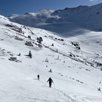
Upper Straight Creek TH
This trail heads up the west ridge to overlook Loveland ski area. There are multiple low angle ski routes or more advanced ski routes off of the south east ridge.
Before creating a trip, click “Activities” below to make sure there isn’t already a trip booked to the same place on the same date.
For further information and any restrictions see: White River National Forest - Dillon Ranger District (usda.gov)
Directions to parking lot: MM 213 Westbound Chain Station - Google Maps
The Straight Creek trailhead is on the west side of the Eisenhower tunnel. There is a short CDOT road you follow until you are in the valley proper. Straight Creek has spectacular flowers in the summer.
Alternate title data:
Upper Straight Creek TH to Coon Hill: 4.9 miles - 1700 ft elevation gain
Upper Straight Creek TH to Hagar Mountain: 5.8 miles - 2058 ft elevation gain
Upper Straight Creek TH to Golden Bear Peak: 8.5 miles - 2562 ft elevation gain
The hike to the top of Loveland ski area is moderate and has a well-established trail. The skiing can be very good, it is mostly above treeline. You can ski moderate slopes below Coon Hill or further north up the valley. There are steeper slopes off of the southeast that can be skied in the spring. Coon Hill is a popular ski mountaineering destination. An unnamed peak at the head of the valley is an intersection of three counties, Grand, Clear Creek and Summit.
- Suitable Activities: Backcountry Skiing/Splitboarding, Hiking, Scrambling, Ski Mountaineering
- Seasons: Year-round
- Weather: View weather forecast
- View avalanche forecast.
-
Land Manager:
U.S. Forest Service
Dillon Ranger District (WRNF)
- Parking Permit Required: USFS Permits & Passes
- Recommended Party Size: 12
- Maximum Party Size: 12
- Maximum Route/Place Capacity: 12
This is a list of titles that represent the variations of trips you can take at this route/place. This includes side trips, extensions and peak combinations. Not seeing a title that fits your trip? Log in and send us updates, images, or resources.
- Upper Straight Creek TH to Coon Hill
- Upper Straight Creek TH to Hagar Mountain
- Upper Straight Creek TH to Golden Bear Peak
There are no resources for this route/place. Log in and send us updates, images, or resources.
