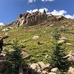
Twin Cones from Kenosha Pass
This is a strenuous lollipop hike of about 17 miles and 3500' of gain. Starting from Kenosha pass, follow 4wd roads, single track trail and some off trail to visit North Twin Cone, Blaine and South Twin Cone peaks.
This is a fairly strenuous 17 mile hike, ideal hike to do during fall foliage. Visit three 12,000+ foot peaks in the Lost Creek Wilderness. Views of the 13ers by 285, Evans and Bierstadt. This hike is a mix of 4wd road walk, nice single track and some off-trail.
- Suitable Activities: Hiking
- Seasons: Year-round, September, October, November
- Weather: View weather forecast
- Difficulty: Strenuous
- Length: 17.0 None
- Elevation Gain: 3,500 ft
- 12,292 ft
-
Land Manager:
Land Manager Varies
Lost Creek Wilderness Area
- Parking Permit Required: Other
- Recommended Party Size: 12
- Maximum Party Size: 12
- Maximum Route/Place Capacity: 12
There are no resources for this route/place. Log in and send us updates, images, or resources.
