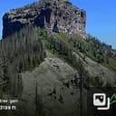
Square Top Mtn
Moderately steep and challenging hike from Guanella Pass. 7 miles, 2,000 feet loop hike.
At 13,794' Square Top Mountain is the 111th highest peak in Colorado. Situated in Colorado's Front Range, near Guanella Pass, Square Top lies midway between the 14er duos of Evans-Bierstadt and Grays-Torreys.
TH is at the parking lot on the west side of Guanella Pass. Location - 39.59741348027969, -105.71280730380566
- Suitable Activities: Hiking
- Climbing Category: Intermediate Alpine Climb
- Seasons: Year-round
- Weather: View weather forecast
- Difficulty: Mod C
- Length: 7.0 mi
- Elevation Gain: 2,454 ft
- 13,783 ft
-
Land Manager:
Land Manager Varies
Clear Creek Ranger District (ARNF)
- Parking Permit Required: Other
- Recommended Party Size: 10
- Maximum Party Size: 12
- Maximum Route/Place Capacity: 12
This is a list of titles that represent the variations of trips you can take at this route/place. This includes side trips, extensions and peak combinations. Not seeing a title that fits your trip? Log in and send us updates, images, or resources.
- Argentine Peak via Square Top Mountain
- Square Top Lakes
There are no resources for this route/place. Log in and send us updates, images, or resources.
