Spruce Creek TH
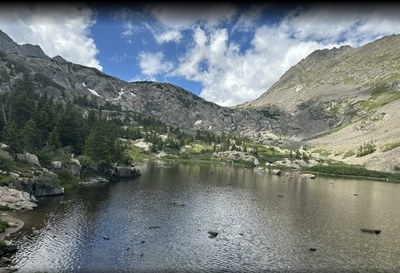
This beautiful trails that start here pass mountain lakes in the White River National Forest south of Breckenridge. Connects with a number of other trails and provides access to the CDT.
Parking here is free but the lot fills quickly and no overflow parking is allowed along the road. There is no bathroom or water at the TH. Maps differ whether the entire trail is "Spruce Creek Trail " or whether it transitions to "Mohawk Lakes Trail."
From the TH use Spruce Creek Rd (USFS #803.1 and #800.1) to reach the Mayflower Lakes TH (one way) - 1.25 miles, 600' gain
From the TH use Burro Trail (USFS 803.1/#80) to reach the Burro TH near Breckenridge (one way) - 3.6 miles, 300+/1000-
Alternate Titles:
Mohawk Lakes - 8.4 miles, 2106' gain
Spruce Creek Loop - 5.25 miles, 1250' gain
- Suitable Activities: Hiking, Snowshoeing
- Snowshoeing Category: Intermediate
- Seasons: Year-round
- Weather: View weather forecast
- View avalanche forecast.
- Difficulty: Challenging
- 12,500 ft
-
Land Manager:
U.S. Forest Service
Dillon Ranger District (WRNF)
- Parking Permit Required: USFS Permits & Passes
- Recommended Party Size: 8
- Maximum Party Size: 12
- Maximum Route/Place Capacity: 12
- COTREX
- AllTrails
- USFS
- CoTrex
- USFS White River National Forest
- SummitPost
This is a list of titles that represent the variations of trips you can take at this route/place. This includes side trips, extensions and peak combinations. Not seeing a title that fits your trip? Log in and send us updates, images, or resources.
- Spruce Creek TH - Mohawk Lakes
- Spruce Creek TH - Spruce Creek Loop
There are no resources for this route/place. Log in and send us updates, images, or resources.
