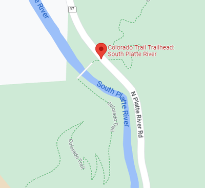
South Platte River Trailhead
The South Platte River Trailhead next to the Gudy Gaskill bridge (which crosses the South Platte River) marks the intersection of Colorado Trail #1776 Segments 1 & 2 with Jefferson County Route 97
The large parking lot has Vault toilet. The trailhead provides easy access to the end of Segment 1 and the beginning of Segment 2.
The South Platte River is the Douglas County & Jefferson County boundary
FS https://www.fs.usda.gov/recarea/psicc/recreation/recarea/?recid=82634&actid=24
Google Map https://goo.gl/maps/Nq9TMd4JmomE8UZ47
Colorado Trail Info https://www.fs.usda.gov/recarea/psicc/recarea/?recid=12992
- Suitable Activities: Backpacking, Hiking
- Seasons: Year-round
- Weather: View weather forecast
- 6,120 ft
-
Land Manager:
Land Manager Varies
South Platte Ranger District (PSINF)
- Parking Permit Required: Other
- Recommended Party Size: 12
- Maximum Party Size: 12
- Maximum Route/Place Capacity: 25
- CalTopo
This is a list of titles that represent the variations of trips you can take at this route/place. This includes side trips, extensions and peak combinations. Not seeing a title that fits your trip? Log in and send us updates, images, or resources.
- South Platte River TH to Chair Rocks
- South Platte River TH to Colorado Trail Segment 1
- South Platte River TH to Colorado Trail Segment 2
- South Platte River TH to Lenny's Rest
- South Platte River TH to Bear Creek
There are no resources for this route/place. Log in and send us updates, images, or resources.
