Sourdough Trail
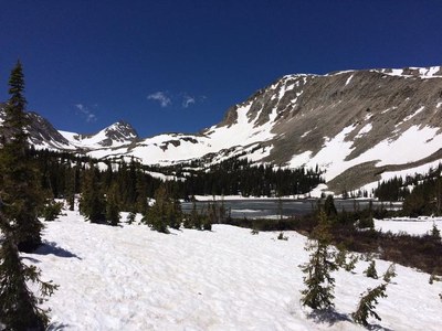
The Sourdough Trail stretches nearly 13 miles (south-north) from Rainbow Lakes Road to Camp Dick in the Roosevelt National Forest. This versatile trail runs along the eastern slopes of the Indian Peaks Wilderness. The following describes the 5.3 mile section from Rainbow Lakes Road to the Red Rock Parking Area on Brainard Lake Road.
Please view this document with everything you need to know about Indian Peaks Wilderness
The trail heads north in a lodgepole forest until bending west (.75 miles) up the east flank of Niwot Mountain (11,471'), trail crosses Peace Memorial Bridge (2.5 miles : 9,924') over Four Mile Creek and switchbacks twice before resuming a steady pace and northerly heading. The forest opens momentarily (4.0 miles : 10,282') with panoramas of the Peak-to-Peak Highway corridor, undulating with a net elevation loss to the Little Raven Ski Trail split (5.35 miles : 10,068'). Travel moderates over Left Hand Creek (5.7 miles : 10,071') to the Red Rock parking area on Brainard Lake Road (5.8 miles : 10,075'). Those with time may consider a short walk to Red Rock Lake, a popular fishing and camping destination.
- Suitable Activities: Hiking, Snowshoeing
- Snowshoeing Category: Intermediate
- Seasons: Year-round
- Weather: View weather forecast
- Avalanche Terrain Rating Simple
- Length: 5.3 mi
- Elevation Gain: 711 ft
- 10,220 ft
-
Land Manager:
U.S. Forest Service
Indian Peaks Wilderness Area, Boulder Ranger District (ARNF)
- Parking Permit Required: USFS Permits & Passes
- Recommended Party Size: 12
- Maximum Party Size: 15
- Maximum Route/Place Capacity: 12
There are no resources for this route/place. Log in and send us updates, images, or resources.
