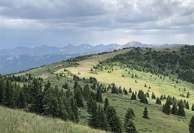
Shrine Mountain
This mountain is a favorite wildflower area in the summer and a favorite snow sports area in the winter. The Shrine Mountain Inn provides hut rentals throughout the year through the 10th Mountain Division Hut system.
The usual hike up is on the Shrine Mountain Ridge Trail TH is at I-70 Exit 190 / Vail Pass
Note the Shrine Mountain Ridge Trail is closed summer 2023 for maintenance. The nearby rest area restrooms also are closed until further notice for repair and maintenance.
Paid parking for Ridge Trail hikers, included for paid Inn visitors.
Many off-trail OB opportunities in the winter, especially from the Inn huts.
- Suitable Activities: Family, Hiking, Nordic Skiing, Snowshoeing
- Snowshoeing Category: Basic
- Seasons: Year-round
- Weather: View weather forecast
- Avalanche Terrain Rating Challenging View avalanche forecast.
- Difficulty: Moderate
- Length: 4.0 mi
- Elevation Gain: 1,100 ft
- 11,881 ft
-
Land Manager:
U.S. Forest Service
Eagle Ranger District (WRNF)
- Parking Permit Required: USFS Permits & Passes
- Recommended Party Size: 12
- Maximum Party Size: 12
- Maximum Route/Place Capacity: 12
- COTREX
- AllTrails
This is a list of titles that represent the variations of trips you can take at this route/place. This includes side trips, extensions and peak combinations. Not seeing a title that fits your trip? Log in and send us updates, images, or resources.
- Shrine Mountain Ridge Trail #2016
- Wilder Gulch Trail #75
- Colorado Trail Segment 8 passes nearby
- existing activities: https://www.cmc.org/education-adventure/trips/find-trips/hiking-2013-this-hike-is-4-3-miles-round-trip-with-an-elevation-gain-of-1000-wildflowers-galore-and-views-of-surrounding-peaks
- Existing R/P Shrine Mountain Inn R/P: https://www.cmc.org/education-adventure/trips/routes-places/shrine-mountain-inn should be merged into this R/P
There are no resources for this route/place. Log in and send us updates, images, or resources.
