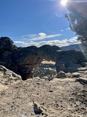
Shaw's Arch
This is trail is approximately 6.5 miles, 1,040 feet total elevation gain and follows mostly OHV trails to a sandstone arch on the edge of a high bluff. Hike begins at the Seep Springs trailhead outside Canon City, Colorado.
- Suitable Activities: Hiking
- Seasons: Year-round
- Weather: View weather forecast
- Difficulty: Easy
- Length: 6.5 mi
- Elevation Gain: 1,040 ft
- 6,700 ft
-
Land Manager:
Bureau of Land Management
Royal Gorge Field Office
- Parking Permit Required: BLM Permits & Passes
- Recommended Party Size: 12
- Maximum Party Size: 12
- Maximum Route/Place Capacity: 12
- https://www.blm.gov/sites/default/files/docs/2022-08/BLM_CO_RGFO_SeepSprings_Map_20220310.pdf
There are no resources for this route/place. Log in and send us updates, images, or resources.
