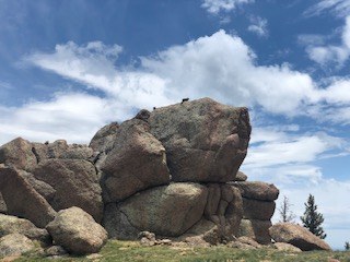
Saint Charles Peak
The second highest peak in the Wet Mountains can be reached 3 ways, 2 encountering a 2700' elevation gain in 4.5 or 6.5 miles, the 3rd climbing 500' in 2.2 miles. The last 150' are above timberline, and above the trail. The summit, unprepossessing by itself, has a spectacular view from the Spanish Peaks, the Sangre de Cristo range and Saguache, to Pikes Peak and the eastern prairie.
The most popular route is the Saint Charles trail from Hwy 165 between San Isabel and Bishop's Castle. It climbs 2700' in 4.5 miles. The trail is used by motorcycles and can be rocky in places. Near the top it breaks out of the woods briefly to an open saddle with twisted trees and rock outcrops, then goes back into trees for 1/4 mile. As the trail starts to descend, turn south and climb 150' up the grassy slope to the summit.
The south end of the Saint Charles trail begins in the San Isabel Recreation area and is less used. A car shuttle can be arranged if one wants to hike the whole trail. The trailheads are about 4 miles apart.
For the easiest route, find FS 369, the Ophir Creek or Greenhorn road, at mile 13 of Hwy 165, and drive up it about 11 miles to FS 335 on your left. Cars can be left there; 4wd is recommended for the next 1.6 miles to a remote campsite. A short side trail leads to the Saint Charles trail coming up from Lake Isabel. Turn north (left) and continue through a wonderful forest of bristlecones to the apex of the trail, where you turn south 150' up to the summit.
- Suitable Activities: Backpacking, Biking, Hiking, Snowshoeing, Trail Running
- Snowshoeing Category: Intermediate
- Seasons: March, April, May, June, July, August, September, October
- Weather: View weather forecast
- Difficulty: Mod C
- Length: 9.2 mi
- Elevation Gain: 2,700 ft
- 11,789 ft
-
Land Manager:
U.S. Forest Service
San Carlos Ranger District (PSINF)
- Parking Permit Required: USFS Permits & Passes
- Recommended Party Size: 12
- Maximum Party Size: 12
- Maximum Route/Place Capacity: 12
- AllTrails
- Saint Charles Peak USGS topo map
This is a list of titles that represent the variations of trips you can take at this route/place. This includes side trips, extensions and peak combinations. Not seeing a title that fits your trip? Log in and send us updates, images, or resources.
- Saint Charles from Hwy 165
- Saint Charles from San Isabel
- Saint Charles from the Greenhorn road
There are no resources for this route/place. Log in and send us updates, images, or resources.
