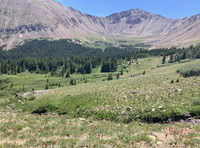
Ruby Gulch
Accessible soon after the entrance to Henderson Mine Road and the Big Bend Picnic Area, the trailhead is found on CR-203/CR-146.1 Woods Creek Road, heading south. Read the latest AllTrails trip reports for route conditions and route following tips.
The trail offers access along Ruby Creek to a cirque area between Red and Woods Mountains to the right/west, and Engelmann and Robeson Peaks on the left/east. Bard and Parnassus ahead, and eventually down into Watrous Gulch.
If one keeps to the right instead, following Woods Creek Road, CR-203, access to Urad Lake, with Woods and Machebeuf Mtns on the left. An off-trail scramble could eventually lead to the Herman Gulch Trail.
A mountaineering traverse also is possible, following along the tops of Engleman 13362', Robeson 13140', Bard 13641', Parnassus 13574', and Woods 12940'.
Location on TH - Ruby Gulch Trailhead - Google Maps
Alternate title -
Ruby Gulch near Empire
Engelmann, Robeson, Bard, Parnassus traverse - 9 miles - 4700 ft elevation gain
Engelmann, Robeson, Bard, Parnassus, Woods traverse - 9 miles - 5200 ft elevation gain
- Suitable Activities: Hiking, Mountaineering
- Seasons: May, June, July, August, September, October
- Weather: View weather forecast
- Avalanche Terrain Rating Complex View avalanche forecast.
- Difficulty: Challenging
- Length: 5.0 mi
- Elevation Gain: 1,512 ft
- 11,821 ft
- Land Manager: Clear Creek County
- Parking Permit Required: Other
- Recommended Party Size: 12
- Maximum Party Size: 12
- Maximum Route/Place Capacity: 12
- AllTrails
This is a list of titles that represent the variations of trips you can take at this route/place. This includes side trips, extensions and peak combinations. Not seeing a title that fits your trip? Log in and send us updates, images, or resources.
- Ruby Gulch near Empire
- Ruby Gulch - Engelmann, Robeson, Bard, Parnassus traverse
- Ruby Gulch - Engelmann, Robeson, Bard, Parnassus, Woods traverse
There are no resources for this route/place. Log in and send us updates, images, or resources.
