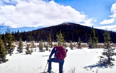
Royal Mountain

This mountain is immediately to the east of the Tanglewood Trail. Summiting it requires off-trail navigation and some scrambling.

Use the Tanglewood Trail, starting at the Deer Creek TH, 8704-8798 Deer Creek Rd Bailey, CO 80421.  
 
Here are a couple of suggested routes:
 
One possibility is to follow the trail until about 2.83 miles, at elev 10923,’ just before the start of the switchbacks.  Turn right and ascend across and up the flattest contour.  After an initial bushwhack, the terrain opens up for the remainder of the hike straight to the summit.  About 8.5 miles, 2350’ gain.
 
Another possibility is to leave the trail at about .7 miles, elev 9600,’ then scramble up to the south ridge, following the ridge to the summit. Once at the summit, you can return to the trail toward the N/NW, reversing the way described above, or plunge straight down the west side, bearing SW, back down to the trail. About 5 miles, 2100’ gain. 
 
Note - This mountain in the Blue Sky Wilderness near Bailey should not be confused with Mt Royal near Dillon in the Tenmile Range.
 

Location of TH - Deer Creek Trailhead - Google Maps

  • Difficulty: Challenging
  • Length: 10.0 mi
  • Elevation Gain: 2,300 ft
  • 11,495 ft
  • Land Manager: U.S. Forest Service
    Mount Blue Sky Wilderness Area (formerly Mount Evans), South Platte Ranger District (PSINF)
  • Parking Permit Required: USFS Permits & Passes
  • Recommended Party Size: 12
  • Maximum Party Size: 12
  • Maximum Route/Place Capacity: 12
Map
8704-8798 Deer Creek Rd Bailey, CO 8042
Activities
Trip Reports
Resources

There are no resources for this route/place. Log in and send us updates, images, or resources.