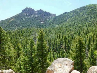
Rolling Creek Trail
This trail enters the Lost Creek Wilderness and eventually meets the Wigwam Trail, providing access to the entire Wilderness. Colorado Trail segments #3 and #4 also meet at the same TH area.
Please view this document with everything you need to know about Indian Peaks Wilderness
For further information and any restrictions see: Pike-San Isabel National Forests & Cimarron and Comanche National Grasslands - Rolling Creek Trail #663 (usda.gov)
Directions to parking and the TH: Rolling Creek Trailhead - Google Maps
From Bailey, go east on County Road 68 which becomes Forest Road 560. Go right at the Y onto County Road 543. 7.8 miles from Bailey park at a small parking area on the south side of the road (large enough for trailers) or go right (south) a short distance to the Colorado Trail/Rolling Creek trailhead.
From the trailhead at end of the road, the Colorado Trail bears right (west) and the Rolling Creek Trail heads left (east). This trail (#663) starts off easy and gets more steadily more challenging as it continues. The high point of the trail is a saddle between the Rolling Creek and Wigwam Creek drainages. From the saddle the trail continues down to where it meets the Wigwam Trail.
Although the trail is open all year, County Roads may not be plowed all the way to the TH.
To review the Trip Leader Checklist see: Shared R:P+Trip Leader Activity Checklists - Google Docs
- Seasons: Year-round
- Weather: View weather forecast
- Avalanche Terrain Rating Simple View avalanche forecast.
- Difficulty: Difficult
- Length: 13.0 mi
- Elevation Gain: 2,450 ft
- 10,661 ft
-
Land Manager:
U.S. Forest Service
Indian Peaks Wilderness Area, South Platte Ranger District (PSINF)
- Parking Permit Required: USFS Permits & Passes
- Recommended Party Size: 12
- Maximum Party Size: 12
- Maximum Route/Place Capacity: 12
- Nat Geo #135
There are no resources for this route/place. Log in and send us updates, images, or resources.
