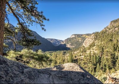
Roaring Creek Trail
A lightly used trail offering a variety of terrain and wildlife sightings, restored after the 2020 Cameron Peak Fire.
The trail starts off CO14 and climbs 5 miles along Roaring Creek. It is an out and back trail, with steep switchbacks the first mile through sagebrush, gaining approximately 900ft, then levels out some and climbs more gradually through forests along the creek until Bald Mountain Road, a 4-wheel drive road, the turn around point. It is approximately 10 miles total, and has 2,141ft. elevation gain. In winter snowshoes are usually needed after the first 1.5 miles, and there is an unbridged crossing at approximately 3 miles that may be difficult to cross during the spring high water flows. There are often moose and elk on the upper stretch of the trail. The trail was closed due to severe damage from the Cameron Peak fire, but Poudre Wilderness Volunteers repaired and improved it, and reopened it in June 2023. Public_RoaringCreek.pdf
See Add to description this is USFS #952 https://www.fs.usda.gov/recarea/arp/recarea/?recid=36843
Trailhead location - https://maps.app.goo.gl/bjNZubcM2n4BHkDH8
- Suitable Activities: Backpacking, Hiking, Snowshoeing
- Snowshoeing Category: Intermediate
- Seasons: Year-round
- Weather: View weather forecast
- Length: 10.0 mi
- Elevation Gain: 2,141 ft
- 9,821 ft
-
Land Manager:
U.S. Forest Service
Cache La Poudre Wilderness Area, Canyon Lakes Ranger District (ARNF)
- Parking Permit Required: Other
- Recommended Party Size: 12
- Maximum Party Size: 12
- Maximum Route/Place Capacity: 12
- caltopo
- COTREX
This is a list of titles that represent the variations of trips you can take at this route/place. This includes side trips, extensions and peak combinations. Not seeing a title that fits your trip? Log in and send us updates, images, or resources.
- Roaring Creek
There are no resources for this route/place. Log in and send us updates, images, or resources.
