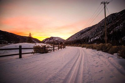
Rio Grande Trail
The Rio Grande Trail is a rails-to-trails project offering 42 miles of gentle slope from Glenwood Springs to Aspen. The trail is completely protected from vehicular traffic except at intersections, which also are entry points.
The Rio Grande Trail is open to all non-motorized uses. Wheelchairs, both motorized and non-
motorized, are permitted. The trail is mostly asphalt or concrete, 8 to 10 feet wide with soft
surface shoulders of 2 to 6 feet on either side.
See detailed information at - Rio Grande Trail - Information | Aspen to Glenwood Springs (rfta.com)
maps at - 23006_2023-rio-grande-trail-brochure_web1.pdf (rfta.com)
You can proceed uphill from Glenwood, downhill from Aspen, or travel just a portion of the
trail. Ride to your start or return to where you started by boarding the bus at various RFTA bus
stops along the way in towns such as El Jebel and Carbondale.
Picnic tables and benches, trash cans, recycle bins and dog waste stations are provided along
the way. There is only one potable water source on the trail, at the Basalt trailhead next to the
Basalt High School, so bring your own water! Vault toilets are installed at the vicinity of Cattle
Creek and Catherine Store Bridge. During the winter months, the trail is plowed when snowfall
exceeds 3” between Glenwood Springs and Main Street, Carbondale. Other sections may be
groomed for cross-country skiing or remain unmaintained for snowshoeing.
Map start GPS: Two Rivers Park, Glenwood Springs Two Rivers Park - Google Maps
Map end GPS: Herron Park, Aspen Herron Park - Google Maps
- Suitable Activities: Biking, Hiking, Snowshoeing
- Seasons: Year-round
- Weather: View weather forecast
- Difficulty: Easy
- Length: 42.4 mi
- Elevation Gain: 140 ft
- 7,889 ft
- Land Manager: Land Manager Varies
- Parking Permit Required: Other
- Recommended Party Size: 12
- Maximum Party Size: 12
- Maximum Route/Place Capacity: 12
- COTREX
- https://www.rfta.com/trail-information/#
There are no resources for this route/place. Log in and send us updates, images, or resources.
