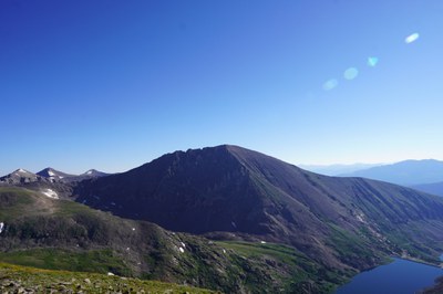
Quandary Peak
Quandary Peak is the highest summit of the Ten Mile Range and is the most commonly climbed fourteener in Colorado. It stands at 14,272 feet. Total Gain: 2,650 feet. 7.2 miles. Class 3 scramble. The standard East Ridge Route is 6.75 miles and 3,450' of elevation gain RT.
Before creating a trip, click “Activities” below to make sure there isn’t already a trip booked to the same place on the same date.
For further information and any restrictions see: White River National Forest - Quandary Peak TH #47 (usda.gov)
Directions to trailhead: Quandary Peak Trailhead - Google Maps
Alternate title data:
Quandary Peak with descent via Cristo Couloir.
Quandary Peak via North Couloir.
Quandary Peak via East Ridge (standard route)
Quandary Peak via West Ridge
Via the West Ridge route, this climb includes hiking on Blue Lakes road (approx. 0.75 mile) as parking at the damn is not allowed. From the east end of the damn follow the sometimes faint trail, gradually ascending westward into the valley, away from the lake. Near 12,300', you will pass the old mine. Continue north through the basin and locate a gully to the northwest at approx. 12,400ft. Climb the left side of the gully, turn right and continue north on talus toward the end of the upper basin. Stay on the left side of the basin and at 13,100', turn left to exit the basin by ascending rock slabs and possibly snow fields.
Initially remaining on the right side of the ridge, is more advisable. Difficulty increases as you near 14,000ft. You will encounter a gully on the north side of the ridge that often holds ice well into summer. Descent is via Quandary East Ridge (standard route), 3.4 miles.
Quandary Peak - South Gully aka Cristo Couloir
The south gully (aka Cristo Couloir) is recommended for snow climbing/skiing. From the Blue Lakes trailhead, walk up to the pavement on top of the dam. From the north end, hike south toward the gully and ascend 200 feet through rock and bushes to reach an open area and continue to the gully. Enter the gully and ascend snow in the center or rocks on the left side. Above 13,200', the gully widens to steeper. The steepest section is between 13,500' to 13,800'. Near 13,900', angle right (east) to gain the summit.
- Suitable Activities: Backcountry Skiing/Splitboarding, Climbing, Hiking, Mountaineering, Scrambling, Ski Mountaineering, Snowshoeing
- Seasons: Year-round
- Weather: View weather forecast
- View avalanche forecast.
- 14,272 ft
-
Land Manager:
U.S. Forest Service
Dillon Ranger District (WRNF)
- Parking Permit Required: Other
- Recommended Party Size: 12
- Maximum Party Size: 17
- Maximum Route/Place Capacity: 12
This is a list of titles that represent the variations of trips you can take at this route/place. This includes side trips, extensions and peak combinations. Not seeing a title that fits your trip? Log in and send us updates, images, or resources.
- Quandary Peak with descent via Cristo Couloir
- Quandary Peak via North Couloir
- Quandary Peak via East Ridge
- Quandary Peak via West Ridge
- Quandary Peak - South Gully aka Cristo Couloir
There are no resources for this route/place. Log in and send us updates, images, or resources.
