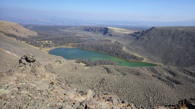
Powderhorn Lakes Trail
A trail hike southwest of Gunnison to an alpine lake.
This hike begins at 11,140' and follows an established trail for about five miles to a remote lake located at tree line. The access road is 10 miles long and can be driven with a normal 2WD vehicle. NO dogs.
The Powderhorn Wilderness is co-managed by USFS Gunnison Ranger District. Wilderness Rules apply, including special rules for the Powderhorn Wilderness.
- Seasons: June, July, August
- Weather: View weather forecast
- Difficulty: Moderate
- Length: 10.0 mi
- Elevation Gain: 1,050 ft
- 11,870 ft
-
Land Manager:
U.S. Forest Service
Powderhorn Wilderness Area
- Parking Permit Required: USFS Permits & Passes
- Recommended Party Size: 12
- Maximum Party Size: 15
- Maximum Route/Place Capacity: 15
- COTREX
- AllTrails
- CalTopo
There are no resources for this route/place. Log in and send us updates, images, or resources.
