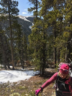
Pendleton Mountain
Pendleton Mountain 12275'. This mountain rises above Georgetown, I-70, and Silver Plume.
The easiest trail is a long walk-up from a parking area along a hairpin turn on Guanella Pass Road, near several interpretive view signs; 39.683233, -105.702740. Have the summit coordinates on your GPS before you start. Follow old mining roads up to a long ridge trail along the bottom of Leavenworth Mountain above and parallel to Leavenworth Creek Road, turning toward the summit at about 11,000,' 39.68222, -105.75130. The walk up is through forest with deadfall until you break out onto alpine tundra.
A second way up involves walking up (or driving, although the road is bad even for 4WD cars) Leavenworth Creek Rd to a drainage point: 39.674889, -105.732089. Follow the drainage up to about 11,500' then turn NW to about 12,100' at which point you can head north to the summit.
Via Frank's Cabin
- Suitable Activities: Hiking
- Seasons: July, August, September, October
- Weather: View weather forecast
- Avalanche Terrain Rating Complex View avalanche forecast.
- Difficulty: Challenging
- Length: 5.0 mi
- Elevation Gain: 1,800 ft
- 12,275 ft
-
Land Manager:
U.S. Forest Service
Clear Creek Ranger District (ARNF)
- Parking Permit Required: USFS Permits & Passes
- Recommended Party Size: 12
- Maximum Party Size: 12
- Maximum Route/Place Capacity: 12
- COTREX
- CalTopo
This is a list of titles that represent the variations of trips you can take at this route/place. This includes side trips, extensions and peak combinations. Not seeing a title that fits your trip? Log in and send us updates, images, or resources.
- Pendleton Mountain - Along the bottom of Leavenworth Mountain
- Via Frank's Cabin
There are no resources for this route/place. Log in and send us updates, images, or resources.
