Palisade Rim
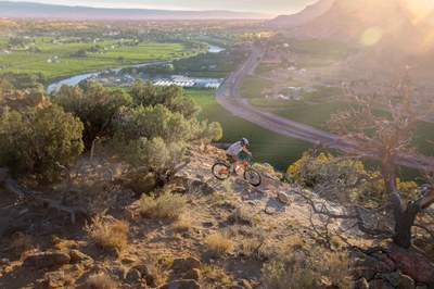
This beautiful hiking trail in Palisade, CO.
The Palisade Rim SRMA encompasses the rim and bench lands east of the Town of Palisade. Public lands and trails in the area are popular close-to-home recreation destinations for the community of Palisade, neighboring communities and seasonal tourism. The area offers outstanding views of the Grand Valley, the Colorado River, the Little Book Cliffs and the Grand Mesa. It also contains significant cultural and wildlife resources. The map also includes the Palisade Plunge Trail.
The full hike is 13 miles and can take three to seven hours to complete. Hike the lower loop for a shorter, 4-mile hike and enjoy scenic views of orchards and vineyards from 1,000 ft above the valley floor
Map of Palisade Rim Recreation Area
- Suitable Activities: Hiking, Biking
- Seasons: Year-round
- Weather: View weather forecast
- Length: 13.0 mi
- Elevation Gain: 1,514 ft
- 5,356 ft
- Land Manager: Bureau of Land Management
- Parking Permit Required: BLM Permits & Passes
- Recommended Party Size: 12
- Maximum Party Size: 12
- Maximum Route/Place Capacity: 12
There are no resources for this route/place. Log in and send us updates, images, or resources.
