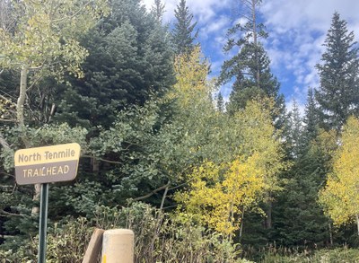
North Tenmile Creek Trail
The North Tenmile Creek trail is a 10.8 mile round trip with an elevation gain of approximately 1,676'. From its start in Frisco, Colorado, the trail ascends gradually through aspen trees, then into a pine forest. There are opportunities to continue beyond the end of the trail to peaks or passes, and to connect to the Gore Range Trail.
This trail starts by passing through a narrow valley. In winter, it is advisable to check the avalanche report. Wichita Mountain is almost immediately to the left (south) at the start of the trail, and Little Chief Mountain is to the right (north). Farther up the trail is Chief Mountain to the right (north). If you continue past the Gore Range Trail, the trail ends 5.4 miles after the parking area.
Getting There:
From I-70, take exit 201. The parking area is on the west side of the highway.
- Suitable Activities: Backcountry Skiing/Splitboarding, Backpacking, Hiking, Nordic Skiing, Snowshoeing
- Snowshoeing Category: Basic
- Seasons: Year-round
- Weather: View weather forecast
- Avalanche Terrain Rating Simple View avalanche forecast.
- Length: 10.8 mi
- Elevation Gain: 1,676 ft
-
Land Manager:
U.S. Forest Service
Eagles Nest Wilderness Area, Dillon Ranger District (WRNF)
- Parking Permit Required: USFS Permits & Passes
- Recommended Party Size: 12
- Maximum Party Size: 12
- Maximum Route/Place Capacity: 12
- caltopo
- AllTrails
- gaiagps
- national geographic
This is a list of titles that represent the variations of trips you can take at this route/place. This includes side trips, extensions and peak combinations. Not seeing a title that fits your trip? Log in and send us updates, images, or resources.
- North Tenmile Creek Trail to Gore Range Trail to Meadow Creek Trail
- North Tenmile Creek Trail to Wichita Mountain
- North Tenmile Creek Trail to Gore Range Trail to Uneva Peak
- North Tenmile Creek Trail to West Deming
There are no resources for this route/place. Log in and send us updates, images, or resources.
