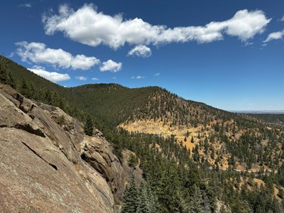
North Cheyenne Canyon Park
North Cheyenne Canyon is a City of Colorado Springs Park located in the foothills just west of town. It includes hiking/biking trails, trailheads for trails that go into the neighboring National Forest, multiple rock-climbing routes and some seasonal waterfall ice.
St Mary's Falls: 5.9 miles, 1,394 feet of elevation gain
Starting up high (7,500') in North Cheyenne Canon (Colorado Springs), follow the closed portion of Old Stage Road to Tunnel #3 (blast into the past of the railway bridge crossing that looms above Cascade Falls), where you join St Mary's Trail. This ends at the bottom of 300' St Mary's Falls.
Daniels Pass, Sweet Water Canyon, Greenland Park Loop: 8 miles, 1,600 feet of elevation gain
Park at Daniels Pass Trailhead Lot 21 in North Cheyenne Canyon Park. Follow Daniels Pass Trail to Sweet Water Canyon Trail. At the Middle Sweet Water and Sweet Water Canyon trail junction take the more primitive trail to Greenland Park with public access granted by a private property owner. Follow the trail to explore numerous historic structures. Return to the trail junction to Sweet Water Canyon Trail following it back to the Daniels Pass Trail to complete the loop.
Mount Muscoco: 4.2 miles (RT), 1,276 feet of elevation gain
Park at the Mount Cutler trailhead and begin the hike following the Mount Cutler trail. After about .5 miles the signed Mount Muscoco trail branches to the right. The route to the summit starts as well defined, but becomes rougher and more exposed as you approach the summit.
Columbine Trail: 6.52 miles (RT), 1,902 feet of elevation gain
A moderate 6.52 mile out and back trail located in North Cheyenne Cañon. Parts of the trail follow North Cheyenne Creek, passing through towering ponderosa pines and steep cliffs and mountains.
Greenwood Park Ghost Town: 6 miles (RT), 1,200 feet of elevation gain
The area features the remains of old structures, including collapsed log cabins, standing walls, chimneys, and rusted scraps, hinting at a past settlement.
Getting There:
Main access is via the gated, central road through the Park- N. Cheyenne Canyon Road. This road starts on the East edge of the park and ends at a large upper parking lot. There is also access to this upper parking lot via Gold Camp Road (dirt) that comes into the Canyon from the north. To reach N. Cheyenne Canyon Road from I-25: exit on Tejon, go South on Tejon, take Cheyenne Blvd at the roundabout and proceed until you see the gated entrance into the park.
Access and parking:
The park is gated, and the road is closed at between 9 or 10 pm and 5 am (seasonal). There is parking just before the main entrance, parking in smaller pull-outs along the road, and a couple of larger parking areas near the top of the road. No entrance fees. Climbing requires a permit that is completed online each calendar year that is good for climbing at all the Colorado Springs city parks.
- Suitable Activities: Backcountry Nordic Skiing, Biking, Climbing, Exploring Nature, Family, Hiking, Trail Running
- Climbing Category: Crag Rock Climb
- Seasons: Year-round
- Weather: View weather forecast
- 8,880 ft
- Land Manager: Colorado Springs
- Parking Permit Required: Other
- Recommended Party Size: 12
- Maximum Party Size: 20
- Maximum Route/Place Capacity: 20
This is a list of titles that represent the variations of trips you can take at this route/place. This includes side trips, extensions and peak combinations. Not seeing a title that fits your trip? Log in and send us updates, images, or resources.
- North Cheyenne Canyon - St Mary's Falls
- North Cheyenne Canyon - Daniels Pass, Sweet Water Canyon, Greenland Park Loop
- North Cheyenne Canyon - Mount Muscoco
- North Cheyenne Canyon - Columbine Trail
- North Cheyenne Canyon - Greenwood Park
There are no resources for this route/place. Log in and send us updates, images, or resources.
