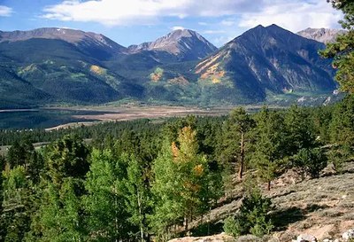
Mt Hope
Mt. Hope is a Class 2 OB hike near Mt Elbert and the Clear Creek drainage near Buena Vista, CO. One of the Top 100 peaks, this hike starts at the Sheep Gulch TH.
Mount Hope (13,933-ft) rests within the backbone of the Colorado Continental Divide, the Sawatch Range. This complex range stretches nearly 100 miles north and south, starting at Tennessee Pass and ending at the Marshall Pass area.
Alternate titles:
Sheep Gulch Trailhead -
This trailhead provides access from the south to the standard East Ridge Route, Southeast Ridge Route, and the mostly-unexplored Southwest Ridge Route.
Willis Gulch Trailhead -
This trailhead provides access from the north, to the standard East Ridge Route, Hopeful Couloir, and Northeast Ridge Route.
- Suitable Activities: Hiking
- Seasons: May, June, July, August, September, October
- Weather: View weather forecast
- Avalanche Terrain Rating Simple View avalanche forecast.
- Difficulty: Difficult
- Elevation Gain: 4,050 ft
- 13,933 ft
-
Land Manager:
U.S. Forest Service
Leadville Ranger District (PSINF)
- Parking Permit Required: USFS Permits & Passes
- Recommended Party Size: 12
- Maximum Party Size: 12
- Maximum Route/Place Capacity: 12
This is a list of titles that represent the variations of trips you can take at this route/place. This includes side trips, extensions and peak combinations. Not seeing a title that fits your trip? Log in and send us updates, images, or resources.
- Mt Hope - Sheep Gulch Trailhead
- Mt Hope - Willis Gulch Trailhead
There are no resources for this route/place. Log in and send us updates, images, or resources.
