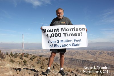
Mount Morrison
Mount Morrison's South Ridge trail is a steep, 2nd class route requiring a small amount of scrambling on the summit block. There's about 2,000 feet of overall elevation gain with the summit at 2,402 metres (7,881 feet). Mount Morrison overlooks the famous Red Rocks amphitheater and a large portion of the Denver metropolitan area.
-
All users of Jeffco parks (both free trips and paid for courses) must carry with them a copy of the CMC-Jeffco Permit or a yellow permit tag
-
The permit can be found at this link
-
Permit tags can be picked up at the CMC Basecamp office (T-Th 10am-6pm)
-
ONLY ONE GROUP may use a trail system at a time. Group size is limited to 14 participants, including guides/instructors.
-
A trail system includes that entire area of that park - ie, if a group begins a hike on the east side of North Table, another group may not hold another hike on the west side of North Table.
-
Blackout dates - No CMC trips may take place on the following dates:
- Memorial Day Weekend - May 24-26; Father’s Day – June 15; Juneteenth – June 19; Independence Day Weekend – July 4-6; Labor Day Weekend – Aug 30-Sept 1
Although there are a number of ways to reach Mount Morrison's summit all are discouraged by land managers with the exception of the South Ridge route. This route is a total of 3.8 miles (6.1 kilometres) roundtrip (out and back), with overall elevation gain of just over 2,000 feet (610 metres). The route is 2nd class with loose gravel in many places and a couple very short scrambling sections on the summit block.
Hikers over responding to COVID precautions substantially widened and eroded the route in 2020 and 2021 by jumping off the trail to avoid one another. In the spring of 2022 Jefferson County Open space began restoration work along the trail. This work included the installaion of many dozens of gabions to thwart erosion and to discourage the creation of ribbon and social trails.
The South Ridge route's trailhead is located at the Titans Road (Entrance 4) to Red Rocks Park and Amphitheatre off of State Highway 74 (Bear Creek Road) a mile or two west of the town of Morrison. At the time of this writing there was adequate parking for about 20 vehicles but, unfortunately, that limit is usually met on most weekend and summer days. There is a temporary, portable restroom at the trailhead and one trash recepticle.
- Suitable Activities: Hiking, Scrambling
- Seasons: Year-round
- Weather: View weather forecast
- Difficulty: Easy B
- Length: 3.8 mi
- Elevation Gain: 2,000 ft
- 7,881 ft
- Land Manager: Jefferson County Open Space
- Parking Permit Required: Other
- Recommended Party Size: 6
- Maximum Party Size: 14
- Maximum Route/Place Capacity: 14
There are no resources for this route/place. Log in and send us updates, images, or resources.
