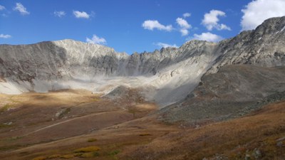
Mayflower Gulch Trailhead
The Mayflower Gulch trailhead can be used to access many locations for hiking, snowshoeing, scrambling, cross-country skiing, and backcountry skiing.
On the west side of the mountain ridge containing Quandary, Atlantic, and Pacific Peaks. There are no restrooms at this location.
Grand Traverse Route: The Mayflower Gulch Grand Traverse the Mayflower Gulch peaks Atlantic, Fletcher, and Drift. There are towers along the way to climb for extra credit. Circumnavigate the peaks of the Mayflower Gulch along a craggy ridge line with loose rock. This route generally requires a rope regardless of direction of travel.
Location of TH - Mayflower Gulch Trail - Google Maps
Alternate titles -
Drift Peak Northwest Ridge - 4 miles - 2500 ft elevation gain
Mayflower Gulch Trail OB
Mayflower Gulch Traverse
Mayflower Gulch to Mayflower Hill
Mayflower Gulch to Humbug Gulch
Mayflower Gulch to Gold Hill
Mayflower Gulch to Atlantic Peak
Mayflower Gulch to Atlantic and Pacific Peaks
Mayflower Gulch Grand Traverse
- Suitable Activities: Backcountry Nordic Skiing, Backcountry Skiing/Splitboarding, Hiking, Scrambling, Snowshoeing
- Seasons: Year-round
- Weather: View weather forecast
- Avalanche Terrain Rating Complex View avalanche forecast.
-
Land Manager:
U.S. Forest Service
Dillon Ranger District (WRNF)
- Parking Permit Required: USFS Permits & Passes
- Recommended Party Size: 12
- Maximum Party Size: 12
- Maximum Route/Place Capacity: 12
This is a list of titles that represent the variations of trips you can take at this route/place. This includes side trips, extensions and peak combinations. Not seeing a title that fits your trip? Log in and send us updates, images, or resources.
- Mayflower Gulch Trail OB
- Mayflower Gulch Traverse
- Mayflower Gulch TH - Drift Peak Northwest Ridge
- Mayflower Gulch to Mayflower Hill
- Mayflower Gulch to Humbug Gulch
- Mayflower Gulch to Gold Hill
- Mayflower Gulch to Atlantic Peak
- Mayflower Gulch to Atlantic and Pacific Peaks
- Mayflower Gulch Grand Traverse
There are no resources for this route/place. Log in and send us updates, images, or resources.
