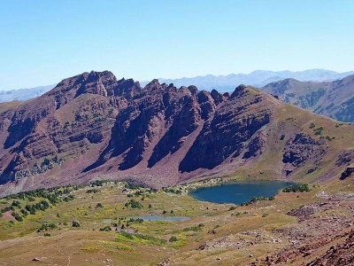
Maroon Snowmass Trail
Enjoy spectacular views of Pyramid and the Maroon Bells peaks and an optional hike to Crater lake.
For further information see: White River National Forest - Maroon-Snowmass Trailhead, #1975 (usda.gov)
Directions to Maroon Snowmass Trailhead: Google Maps
The trail starts at the Maroon Lake and follows the Maroon-Snowmass Trail which climbs on rocky paths through the aspens to a rock “garden” before it descends to Crater Lake. Then it is a steep climb to Minnehaha Gulch. The trail continues its steep ascent exiting the gulch into an alpine meadow. Then it continues to climb next to Buckskin Pass and up and over Willow Pass to Willow Lake.
Snowmass Lake and Mountain - 21.3 miles - elevation gain 5902 ft
Willow Lake - 11.6 miles - elevation gain 3779 ft
- Suitable Activities: Backpacking, Hiking
- Seasons: Year-round
- Weather: View weather forecast
- Difficulty: Difficult A
- Length: 11.6 mi
-
Land Manager:
U.S. Forest Service
Maroon Bells-Snowmass Wilderness Area, Aspen Ranger District (WRNF)
- Parking Permit Required: Maroon Bells Scenic Area
- Recommended Party Size: 8
- Maximum Party Size: 10
- Maximum Route/Place Capacity: 10
- caltopo
- caltopo
This is a list of titles that represent the variations of trips you can take at this route/place. This includes side trips, extensions and peak combinations. Not seeing a title that fits your trip? Log in and send us updates, images, or resources.
- Maroon-Snowmass Trail - Snowmass Lake and Mountain
- Maroon-Snowmass Trail - Willow Lake
There are no resources for this route/place. Log in and send us updates, images, or resources.
