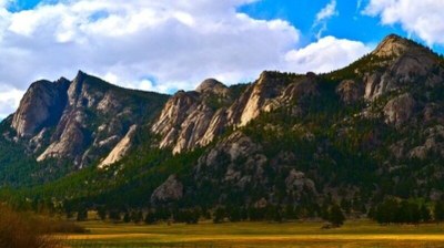
Lumpy Ridge Loop - Rocky Mountain National Park
A loop hike around Lumpy Ridge in Rocky Mountain National Park covers ~11 miles with an elevation gain of around 2,560 feet. The trail offers stunning views of jagged rock formations, lush forests, and panoramic vistas, and Gem Lake. Hikers wind through rugged terrain, passing beneath towering granite cliffs and across open meadows filled with wildflowers, with peaceful spots to pause and take in the beauty of the park's alpine scenery.
Please view this document with everything you need to know about Rocky Mountain National Park
Starting at the Lumpy Ridge Trailhead, this clockwise loop hike in Rocky Mountain National Park begins by heading out on the Black Canyon Trail. This section offers a mix of rolling meadows, wide-open vistas, and rugged terrain as hikers gradually ascend through the valley. The trail then transitions onto the Cow Creek Trail, which leads deeper into the backcountry with expansive views of the surrounding peaks. The fun begins on the Gem Lake Trail offering hikers a steady ascent through forested switchbacks. An optional side trip takes you to Balanced Rock, adding ~2 miles and 400 feet of elevation gain, while providing a striking view of the unique rock formation.
As the loop nears its end, the trail rewards hikers with a stop at Gem Lake, a picturesque and peaceful spot nestled among towering granite formations. This serene lake serves as a perfect place to pause and reflect before the final descent back to the Lumpy Ridge Trailhead. Having Gem Lake near the end of the hike allows for a satisfying conclusion, with the scenic beauty of the lake offering a relaxing respite before finishing the loop.
There are also multiple opportunities for off-trail hikes on the ridge.
The Lumpy Ridge area has long been known for its unique geology, with dramatic granite rock formations that were formed millions of years ago through volcanic activity and later sculpted by glaciers. The area became part of Rocky Mountain National Park when it was established in 1915, including Gem Lake, quickly became a popular destination for both hikers and climbers.
A common route for this trip is: Lumpy Ridge Loop - RMNP | COTREX (colorado.gov), with a side trip to Balanced Rock: Balanced Rock - Side-Trip | COTREX (colorado.gov)
- Suitable Activities: Hiking
- Seasons: Year-round
- Weather: View weather forecast
- Difficulty: Moderate
- Length: 10.5 mi
- Elevation Gain: 2,560 ft
- 9,120 ft
-
Land Manager:
National Park Service
Rocky Mountain National Park
- Parking Permit Required: National Park Entrance Fees
- Recommended Party Size: 12
- Maximum Party Size: 12
- Maximum Route/Place Capacity: 12
- Trails Illustrated 200
There are no resources for this route/place. Log in and send us updates, images, or resources.
