Lumpy Ridge "Hot Rocks" Loop
This mostly off-trail hike of 7 miles with 1,900' of gain is short on distance but high on adventure. It explores some of the obscure rock features of the eastern Lumpy Ridge and climbs to two of the highpoints above Gem Lake in Rocky Mountain National Park.
Please view this document with everything you need to know about Rocky Mountain National Park
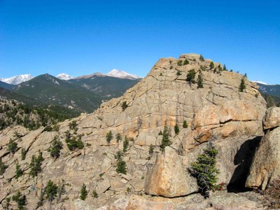
The "Gemstones" are a trio of granite domes on the eastern end of the long Lumpy Ridge. Two of the Gemstones flank the popular Gem Lake (8,820'). The highest one is the West Gemstone (9,120') which is not visible from Gem Lake nor easily accessible. You can summit the West Gemstone by crossing (and summitting) the Middle Gemstone. Along the way, you will crawl (really) through "The Cave", visit "The Boot", explore "The Verandah", and rest on the sandy beach of Gem Lake. From Gem Lake, there is a safe route up the slabby rock of the Middle Gemstone. Dropping your packs and poles, you can take a hidden ramp to the very top and enjoy its outstanding views. The return route from the top is very unique, to say the least!
The West Gemstone will be visible across a huge gap that will look impossible to descend into but there is a safe route. Likewise, climbing the West Gemstone looks daunting but, again, there is a route. There will be a lot of Class 3 scrambling on both of these Gemstones. The rock, however, is solid, grippy, Lumpy Ridge granite.
Leaving the West Gemstone, bushwhack down a steep gully and pick up a faint use trail that locals know as a shortcut to Balanced Rock, the next destination. Balanced Rock is just that, a gigantic boulder balanced on a narrow rock stem. From there, pick up another use trail that will take you past the "Old Man's Profile" on its way to the crest of Lumpy Ridge.
Descend the southern side of Lumpy Ridge on an overgrown use trail passing Rock One and the backside of the Twin Owls formation - the "Bowels of the Owls". From there, descend on the steep climber's trail and take the Black Canyon Trail back to the parking lot.
Note that the Rock One and Twin Owls area is often closed Jan-June for raptor nesting.
- Suitable Activities: Hiking, Scrambling
- Seasons: May, June, July, August, September, October
- Weather: View weather forecast
- Length: 7.0 mi
- Elevation Gain: 1,900 ft
- 9,120 ft
-
Land Manager:
National Park Service
Rocky Mountain National Park
- Parking Permit Required: National Park Entrance Fees
- Recommended Party Size: 9
- Maximum Party Size: 12
- Maximum Route/Place Capacity: 12
There are no resources for this route/place. Log in and send us updates, images, or resources.
