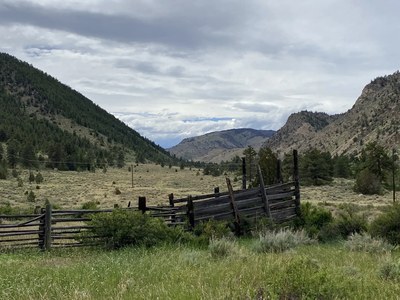
Lower Dadd Gulch Trail
The Lower Dadd Gulch trail is along a small creek in the Poudre Canyon. This out-n-back hike is ~7 miles and 1500 ft of elevation gain. You'll be rewarded with views of the canyon and surrounding area.
This trail winds up a gulch to the southwest on an old jeep track and stock trail before intersecting the old Dadd Gulch/Salt Cabin Park Road. This path is wellworn and easy to follow. In the spring and summer, a small spring-fed stream meanders through the gulch and the trail crosses back and forth over this small, unnamed creek a total of 18 times. Wildflowers can be abundant along the stream, especially in the spring, as well as through the meadows. Between 0.5 mile and 1.5 miles above the trailhead, the trail passes under some utility lines several times. At about 2 miles, the trail heads steeply uphill and away from the stream and passes near several interesting rock outcroppings before climbing gradually through an open area. Soon the trail enters a meadow with a nice grove of quaking aspens. A short distance above the meadow, on the east (left) side of the trail, is a stock tank that lately appears to be empty and nonfunctional. From the tank, the trail continues for another 0.75 mile to the crest of a ridge, which provides nice views of the surrounding country. As you continue up the ridge you will eventually pass through an opening in a barbed-wire fence. The trail ends a few hundred yards further, where it meets the Dadd Gulch/Salt Cabin Park Road. Unfortunately, the last 0.5 mile of the trail is in the Cameron Peak burn area. Return to the trailhead via the same route. (Lower Dadd Gulch Trail | COTREX)
- Suitable Activities: Hiking, Snowshoeing
- Snowshoeing Category: Intermediate
- Seasons: Year-round
- Weather: View weather forecast
- Difficulty: Moderate
- Length: 7.0 mi
- Elevation Gain: 1,500 ft
- 8,490 ft
-
Land Manager:
U.S. Forest Service
Canyon Lakes Ranger District (ARNF)
- Parking Permit Required: USFS Permits & Passes
- Recommended Party Size: 12
- Maximum Party Size: 12
- Maximum Route/Place Capacity: 12
- Trails Illustrated 112
- CalTopo
There are no resources for this route/place. Log in and send us updates, images, or resources.
