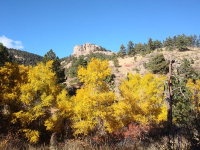
Lory State Park
Lory State Park is a state park located west of Fort Collins, CO. The park offers hiking, mountain biking, climbing, and horseback riding.
Overlook Trail: 4 miles, 950 feet of elevation gain
This relatively short hike of 4 miles includes a surprising amount of gain (950') due to the ascent of Well Gulch and numerous dry drainage crossings. The views of Horsetooth Reservoir and beyond from the Overlook Trail are outstanding. This trail in Lory State Park provides a quieter beautiful walk.
Park at Eltuck picnic area, cross the road, and ascend Well Gulch. At the junction, follow the nature trail rising out of the gulch. Continue south to junction with Overlook Trail and follow it, undulating through dry drainages, forest, outcrops, and open areas. At Arthurs Rock Gulch, head east to connect with the West Valley Trail north to the start.
Arthur's Rock via East Ridge
Arthur's Rock is a large rock outcrop in Lory State Park west of of Fort Collins. To access the east ridge, take the Arthur's Rock Trail for about a mile to the bottom of the rock. The scrambling route mostly follows the east ridge. It features rock slabs, a chimney and a somewhat exposed ramp. It finishes near the top of Arthur's Rock.
Arthur's Rock via Howard Trail: 4.7 miles, 1,250 feet of elevation gain
Panoramic views atop Arthur's Rock on this 4.7 mile, 1250' gain hike via the Howard Trail with a short scramble at the summit in Lory State Park. Begin at the Arthur's Rock trailhead and hike through a little canyon to the intersection with the Howard Trail, and up switchbacks to Arthur's Rock, which we will summit after a short scramble. The views of Horsetooth Reservoir and Fort Collins are well worth the effort.
Well Gulch, Overlook, and Valley Trail: 2.2 miles, 480 feet of elevation gain
A 2.2 mile hike with 480 ft elevation gain. The hike is a loop with a short distance along the Overlook Trail to a view of Horsetooth Reservoir. This is a great trip for some basic navigation discussions. From the Eltuck Picnic Area, cross the road and hike up Well Gulch. Continue on Well Gulch taking a hard left at the intersection with the Timber Rail connector. Continue to the south to the intersection with the Overlook Trail. At the Overlook Trail hike out to an open area where there is a good view of Horsetooth Reservoir (this is a good area to practice triangulation with a map and compass). Turn around and return to the Well Gulch Trail. At the junction go down to the east on the Well Gulch Trail. At the junction with the West Valley trail turn left to the north to return to the trailhead.
Kimmons, Timber, Valley Loop: 4 miles, 700 feet of elevation gain
This loop hike travels 4 miles with 700 feet elevation gain with excellent views of Horsetooth Reservoir and Fort Collins. From Eltuck Picnic Area, head west toward West Valley Trail and north to Kimmons Trail. Ascend the ridge to Timber Trail north and connect to West Valley Trail. Head south to return to Eltuck Picnic Area.
- Suitable Activities: Biking, Hiking
- Seasons: Year-round
- Weather: View weather forecast
- 6,040 ft
-
Land Manager:
Colorado Parks & Wildlife
Lory State Park
- Parking Permit Required: State Parks Entrance Fee / Pass
- Recommended Party Size: 12
- Maximum Party Size: 12
- Maximum Route/Place Capacity: 12
- CalTopo
This is a list of titles that represent the variations of trips you can take at this route/place. This includes side trips, extensions and peak combinations. Not seeing a title that fits your trip? Log in and send us updates, images, or resources.
- Lory State Park - Overlook Trail
- Lory State Park - Arthur's Rock via East Ridge
- Lory State Park - Arthur's Rock via Howard Trail
- Lory State Park - Wells Gulch, Overlook, and Valley Trail
- Lory State Park - Kimmons, Timber, Valley Loop
- Lory State Park - Kimmons Trail
There are no resources for this route/place. Log in and send us updates, images, or resources.
