Lake Isabel Recreation Area
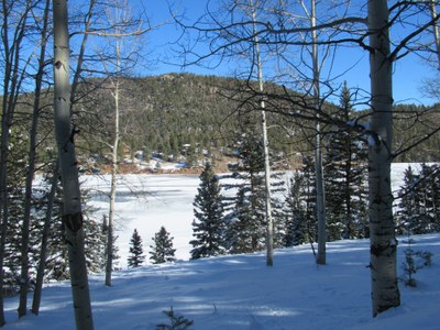
This U.S. Forest Service recreation area in the San Isabel National Forest, on the border of Pueblo and Custer counties, provides camping, picnicking and fishing around a small lake. A web of trails provides access to Wet Mountain peaks and historic sites.
Located on the St. Charles River, at mile 19 of Co. hwy 165, trails lead around the campgrounds and to more ambitious destinations such as St. Charles Peak, Marion Mine and Snowslide trail-Cisneros trail loop. A small store and restaurant are seasonal. Camping, and the roads through the area are closed in winter, & provide excellent Nordic skiing, as this place gets more snow than most.
Marion Mine: 4.5 miles, 900 feet of elevation gain
An easy hike that takes you to the ruins of a deserted mine beside small waterfalls on Amethyst creek. In winter when the San Isabel roads are closed, add 3 easy miles on pavement.
From San Isabel Lake at mile 19 of Hwy 96 drive either road around the lake 1 mile to St. Charles campground, and another 1/2 mile to the trailhead for Cisneros trail #1314. (When the recreation area is closed for the winter, take the north entrance 1/4 mi. to a large parking lot, and add 3 miles to your hike.) The steepest part of the trail is in the first .75 miles, before the St. Charles trail #1326 branches to the right. Half a mile further, the Cisneros trail branches left, while Marion mine is straight ahead less than 1/2 mile. Pass rocky outcrops and a restored cabin on the way to the mine. The cabin and mine are on private property, so mind your manners. The creek offers lovely spots for lunch.
- Suitable Activities: Backcountry Nordic Skiing, Backpacking, Biking, Camping, Exploring Nature, Family, Hiking, Nordic Skiing, Trail Running
- Snowshoeing Category: Basic
- Seasons: Year-round
- Weather: View weather forecast
- 12,300 ft
-
Land Manager:
U.S. Forest Service
San Carlos Ranger District (PSINF)
- Parking Permit Required: USFS Permits & Passes
- Recommended Party Size: 12
- Maximum Party Size: 12
- Maximum Route/Place Capacity: 12
- All Trails
- usgs san isabel
This is a list of titles that represent the variations of trips you can take at this route/place. This includes side trips, extensions and peak combinations. Not seeing a title that fits your trip? Log in and send us updates, images, or resources.
- Lake Isabel Recreation Area - Marion Mine
- Lake Isabel Recreation Area - Snowslide Trail
- Lake Isabel Recreation Area - Logging Road at San Isabel
- Lake Isabel Recreation Area - St. Charles Peak
There are no resources for this route/place. Log in and send us updates, images, or resources.
