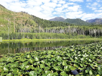
Lake Eileen Trail
The trail and small lake are mostly within an old burn scar that is starting to regrow with aspens and wildflowers.
In the summer the trail is not too shady, so start early. USFS Trail #668. The TH is located off CO-501.
Location - Lake Eileen - Google Maps
- Suitable Activities: Hiking
- Seasons: May, June, July, August, September, October, November
- Weather: View weather forecast
- Avalanche Terrain Rating Simple View avalanche forecast.
- Difficulty: Easy
- Length: 4.2 mi
- Elevation Gain: 1,150 ft
- 8,900 ft
-
Land Manager:
U.S. Forest Service
Weminuche Wilderness Area, Columbine Ranger District (SJNF)
- Parking Permit Required: USFS Permits & Passes
- Recommended Party Size: 12
- Maximum Party Size: 15
- Maximum Route/Place Capacity: 15
- AllTrails
- CoTrex
There are no resources for this route/place. Log in and send us updates, images, or resources.
