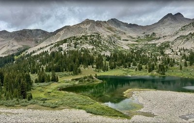
Klondike Mountain
Easy access from Nederland to rolling hill tops. Bordering the backside of James Peak area, on the border of the Indian Peaks Wilderness
Klondike Mountain (10,751') is a hidden gem with still relatively few users. It is the highest of a cluster of six little mountains known as the Caribou District Peaks, which can be accessed via a rough, bush-whack trail that starts at the intersection of Boulder CR-128J and Caribou Rd.
From Nederland, follow Colorado Highway 72 west for 0.5 miles from the traffic circle. Turn west on County Road 128 and follow it five miles to Five Points (identified by the five-way intersection; loosely-organized parking area and gated roads). Numbered campsites are scattered along both segments of NFSR 505 and its off-shoots within 1.5 miles of Five Points. Note: NFSR 505 is seasonally open from around late June or early July through late October or November in most years.
- Suitable Activities: Camping, Hiking, Snowshoeing
- Snowshoeing Category: Intermediate
- Seasons: Year-round
- Weather: View weather forecast
- View avalanche forecast.
- Difficulty: Intermediate Snowshoe
- 10,754 ft
-
Land Manager:
U.S. Forest Service
Boulder Ranger District (ARNF)
- Parking Permit Required: USFS Permits & Passes
- Recommended Party Size: 12
- Maximum Party Size: 12
- Maximum Route/Place Capacity: 12
- AllTrails
- COTREX
This is a list of titles that represent the variations of trips you can take at this route/place. This includes side trips, extensions and peak combinations. Not seeing a title that fits your trip? Log in and send us updates, images, or resources.
- Klondike Mountain - Caribou 5 Loop
There are no resources for this route/place. Log in and send us updates, images, or resources.
