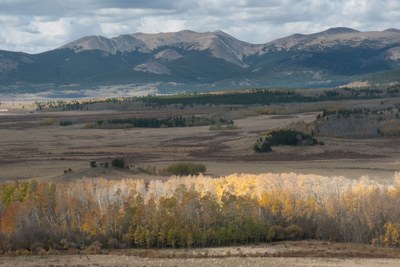
Kenosha Pass
Beautiful location along 285 among many aspen trees, ideal for viewing the change of colors in the fall.
Kenosha Pass East: 5.5 miles, 600 feet of elevation gain
It starts at Kenosha Pass and travels east along the Colorado Trail to a lunch spot with open views.
Kenosha Pass West: 5 miles, 200 feet of elevation gain
From Kenosha Pass head west 2.5 miles over the Colorado Trail to the intersection with the West Jefferson Trail.
- Suitable Activities: Hiking
- Seasons: Year-round
- Weather: View weather forecast
- View avalanche forecast.
- 10,000 ft
-
Land Manager:
U.S. Forest Service
South Park Ranger District (PSINF)
- Parking Permit Required: USFS Permits & Passes
- Recommended Party Size: 12
- Maximum Party Size: 15
- Maximum Route/Place Capacity: 15
This is a list of titles that represent the variations of trips you can take at this route/place. This includes side trips, extensions and peak combinations. Not seeing a title that fits your trip? Log in and send us updates, images, or resources.
- Kenosha Pass East
- Kenosha Pass West
- Kenosha Pass North
There are no resources for this route/place. Log in and send us updates, images, or resources.
