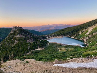
James Peak
A very popular 8 mile 13er with nearly 3000ft elevation gain. You will pass by Saint Mary's Glacier on the way and enjoy stunning 360 degree views at the top.
Although there are multiple routes to James Peak this is the most popular. As such, you should arrive early as parking is limited. This trail is open year round and popular for hiking, skiing and snowshoeing. Dogs are welcome but must be kept on leash. There is a $5 (cash) parking fee at the trailhead.
Alternate title -
James Peak via Loch Lomond - 5.0 miles - 2,088 ft elevation
Getting there:
39.825713°N 105.644°W are the coordinates to the upper lot near trailhead. From Denver take i70 west and exit on Fall River Road exit 238. Stay on Fall River Road for nearly 9 miles to trailhead and/or parking lot.
- Suitable Activities: Hiking, Snowshoeing
- Snowshoeing Category: Intermediate
- Seasons: Year-round
- Weather: View weather forecast
- Difficulty: Mod C
- Length: 8.0 mi
- Elevation Gain: 2,950 ft
- 13,497 ft
-
Land Manager:
U.S. Forest Service
James Peak Wilderness Area, Clear Creek Ranger District (ARNF)
- Parking Permit Required: USFS Permits & Passes
- Recommended Party Size: 12
- Maximum Party Size: 12
- Maximum Route/Place Capacity: 12
- COTREX
- AllTrails
- AllTrails
This is a list of titles that represent the variations of trips you can take at this route/place. This includes side trips, extensions and peak combinations. Not seeing a title that fits your trip? Log in and send us updates, images, or resources.
- James Peak via Loch Lomond
There are no resources for this route/place. Log in and send us updates, images, or resources.
