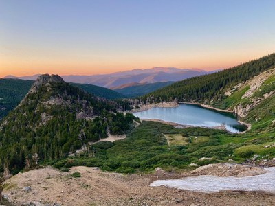
James Peak Wilderness (James Peak, Mt. Bancroft and others)
The James Peak Wilderness area contains several 13'ers as well as a portion of the Continental Divide Trail.
James Peak, via Loch Lomond: 5.0 miles - 2,088 ft. elevation gain
Mt. Bancroft via Loch Lomond: 7.9 miles (RT), 3,030 ft. elevation gain
Getting there:
39.825713°N 105.644°W are the coordinates to the upper lot near trailhead. From Denver take i70 west and exit on Fall River Road exit 238. Stay on Fall River Road for nearly 9 miles to trailhead and/or parking lot.
- Suitable Activities: Hiking, Snowshoeing
- Snowshoeing Category: Intermediate
- Seasons: Year-round
- Weather: View weather forecast
- Difficulty: Mod C
- Length: 8.0 mi
- Elevation Gain: 2,950 ft
- 13,497 ft
-
Land Manager:
U.S. Forest Service
James Peak Wilderness Area, Clear Creek Ranger District (ARNF)
- Parking Permit Required: USFS Permits & Passes
- Recommended Party Size: 12
- Maximum Party Size: 12
- Maximum Route/Place Capacity: 12
- COTREX
- AllTrails
- AllTrails
This is a list of titles that represent the variations of trips you can take at this route/place. This includes side trips, extensions and peak combinations. Not seeing a title that fits your trip? Log in and send us updates, images, or resources.
- James Peak via Loch Lomond
- Mt. Bancroft via Loch Lomond
There are no resources for this route/place. Log in and send us updates, images, or resources.
