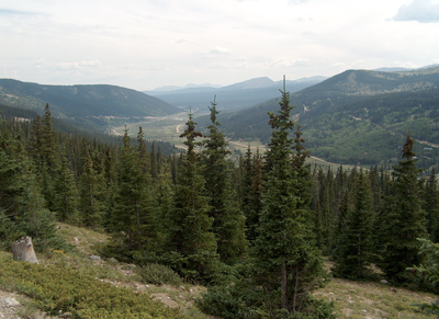
Hoosier Pass
Hoosier Pass is 11,542' on the Continental Divide, located on State Highway 9 between Fairplay and Breckenridge. It lies on the border between Park County and Summit County. The pass is usually open all year, but can close during winter storms.
- Hoosier Pass Loop
- North Star Mountain
- Hoosier Ridge
- Red Mountain
- Mt. Silverheels
Alternate titles -
Hoosier Ridge - 1.5 miles - 1000 ft elevation gain
Hoosier Pass Loop
North Star Mountain
Red Mountain
Mt Siverheels
Hoosier Ridge + Red Mountain C + Read Peak A
- Suitable Activities: Backcountry Nordic Skiing, Backcountry Skiing/Splitboarding, Backpacking, Hiking, Snowshoeing
- Seasons: Year-round
- Weather: View weather forecast
- Avalanche Terrain Rating Complex View avalanche forecast.
-
Land Manager:
U.S. Forest Service
Dillon Ranger District (WRNF)
- Parking Permit Required: USFS Permits & Passes
- Recommended Party Size: 12
- Maximum Party Size: 12
- Maximum Route/Place Capacity: 12
This is a list of titles that represent the variations of trips you can take at this route/place. This includes side trips, extensions and peak combinations. Not seeing a title that fits your trip? Log in and send us updates, images, or resources.
- Hoosier Pass - Hoosier Ridge
- Hoosier Pass - Hoosier Pass Loop
- Hoosier Pass - North Star Mountain
- Hoosier Pass - Red Mountain
- Hoosier Pass - Mt Siverheels
- Hoosier Pass - Hoosier Ridge + Red Mountain C + Read Peak A
There are no resources for this route/place. Log in and send us updates, images, or resources.
