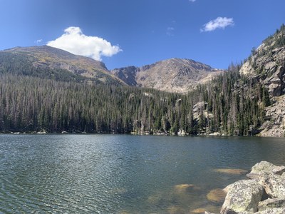
RMNP - Lake Ypsilon
This will be a round trip hike of 9 miles with an elevation gain of 2,400 feet.
Please view this document with everything you need to know about Rocky Mountain National Park
The hike begins at the Lawn Lake trailhead. Over the course of the next couple miles we'll catch sporadic views of Deer Mountain, Longs Peak, and other peaks surrounding Horseshoe Park and Endovalley areas. At just over a mile we will steep banks of Roaring River where we will witness the destruction of the Lawn Lake flood. At roughly 1.4 miles we arrive at the Ypsilon Lake junction. At just over 3.5 miles the trail finally flattens out and descend a short distance to Chipmunk Lake. From its shore we will enjoy views of Ypsilon Mountain. After passing Chipmunk Lake the trail descends about 4.5 miles to Ypsilon Lake. Ypsilon Lake sits at the base of Ypsilon and Chiquita Mountains.
Here is the link to the closure areas, updated year-round: Area Closures to Protect Plants & Animals - Rocky Mountain National Park (U.S. National Park Service) (nps.gov)
- Suitable Activities: Hiking
- Seasons: Year-round
- Weather: View weather forecast
- Length: 9.0 mi
- Elevation Gain: 2,400 ft
-
Land Manager:
National Park Service
Rocky Mountain National Park
- Parking Permit Required: National Park Entrance Fees
- Recommended Party Size: 10
- Maximum Party Size: 12
- Maximum Route/Place Capacity: 12
There are no resources for this route/place. Log in and send us updates, images, or resources.
