High Line Canal
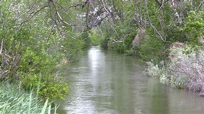
The High Line canal starts in Waterton Canyon and meanders through the metro area all the way to DIA. The canal is 71 miles long and can be divided into 14 segments. Each segment has its own history and views.
The High Line canal starts in Waterton Canyon and meanders through the metro area all the way to DIA. The canal is 71 miles long and can be divided into 14 segments. The segments will be between 4 and 8 miles and mostly flat. Each segment has its own history and views. Check out the High Line Canal Conservancy for information, maps and membership.
Also recommended: The Thunder Tree: Lessons from an urban wildland by Robert M. Pyle.
Alternate titles -
DeKoevend Park to Hampden Ave via Highline Canal
Highline Canal North from Orchard Rd
- Suitable Activities: Biking, Hiking
- Seasons: Year-round
- Weather: View weather forecast
- Elevation Gain: 100 ft
- Land Manager: Denver
- Parking Permit Required: Other
- Recommended Party Size: 12
- Maximum Party Size: 50
- Maximum Route/Place Capacity: 50
This is a list of titles that represent the variations of trips you can take at this route/place. This includes side trips, extensions and peak combinations. Not seeing a title that fits your trip? Log in and send us updates, images, or resources.
- DeKoevend Park to Hampden Ave via Highline Canal
- Highline Canal North from Orchard Rd
There are no resources for this route/place. Log in and send us updates, images, or resources.
