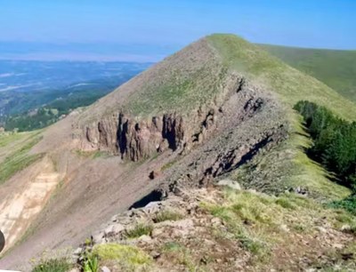
Greenhorn Mountain
Greenhorn Mountain, 12,347', can be accessed from 3 different trailheads; Bartlett Trail, Greenhorn Trail, and the end of Greenhorn Mountain Road, with varying difficulties. It has wildlife viewing and nice views from above timberline.
All 3 trails are in the Greenhorn Mountain Wilderness Area, so mountain bikes and motorized vehicles are prohibited.
Bartlett Trail, #1310, is 16 miles round trip on a difficult trail with 4,347' of elevation gain and starts at the end of Bartlett Trail road.
Greenhorn Trail, #1316, is 18 miles round trip on a difficult trail with 4,872' of elevation gain and starts at Rye Mountain Park. North Peak can be added as a side hike that will add 1.5 miles to the route.
To access the trailhead at the end of Greenhorn Mountain Road, one has to drive around 25 miles from the Ophir Creek Campground on a rough gravel road but is the easiest method of hiking to the top of the mountain. It is 5 miles round trip with around 1,000' of elevation gain. North Peak can be added as a side hike that will add 1.5 miles to the route.
- Snowshoeing Category: Intermediate
- Seasons: Year-round
- Weather: View weather forecast
- Difficulty: varies
- 12,347 ft
-
Land Manager:
U.S. Forest Service
Greenhorn Mountain Wilderness Area, San Carlos Ranger District (PSINF)
- Parking Permit Required: USFS Permits & Passes
- Recommended Party Size: 12
- Maximum Party Size: 12
- Maximum Route/Place Capacity: 12
- usgs san isabel
- usgs Rye
This is a list of titles that represent the variations of trips you can take at this route/place. This includes side trips, extensions and peak combinations. Not seeing a title that fits your trip? Log in and send us updates, images, or resources.
- Greenhorn Mountain Road, Bartlett Trail, Greenhorn Trail
There are no resources for this route/place. Log in and send us updates, images, or resources.
