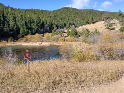
Golden Gate Canyon State Park
Golden Gate Canyon State Park has 42 miles of hiking trails. Located northwest of Golden, CO.
Windy Peak: 6 miles, 1,600 feet of elevation gain
There are couple of well-known routes for Windy Peak that are listed on AllTrails:
- https://www.alltrails.com/trail/us/colorado/windy-peak-via-mountain-lion-and-burro-trail-loop
- https://www.alltrails.com/trail/us/colorado/windy-peak-via-mountain-lion-trail
Or choose your own from the trails map on the park website:
Mountain Lion Loop: 6.7 miles, 1,500 feet of elevation gain
This hikes starts at the Nott Creek trailhead, follows through Forgotten Valley and around Windy Peak. It then descents along Deer Creek and follows a contour back to the Nott Creek parking area.
From this trail you can take a side trip up to City Lights Ridge and also to Windy Peak.
Reach the trailhead either on the paved road past the Visitors Center, or by staying on the Crawford Gulch Road and not taking the turn into the White Ranch park. Note, this road becomes a well maintained dirt road.
Panorama Point: 9.6 miles, 1,446 feet of elevation gain
We will start on the Ole Barn Knoll trailhead and go counterclockwise to Frazer meadow then up to Panorama Point and return through Bootleg Bottom to the start.
Note dogs are welcome on the hike as long as they are on leash.
Horseshoe Trail to Frazer Meadow: 3.8 miles, 944 feet of elevation gain
The Horseshoe Trail follows a seasonal stream with trees and seasonal wildflowers. Frazer Meadow includes ruins of an historic cabin.
Ralston Roost Trailhead Loop: 6 miles, 1,434 feet of elevation gain
Start at Ralston Roost trailhead, hike the Black Bear Trail, and circle around descending the Horseshoe trail.
The Black Bear Trail is a somewhat steep and rocky trail up to Ralston Roost where there are rock outcroppings at the high point of the trail. There is some rock scrambling in this area, but the trail is well marked and not very difficult. Poles are helpful. After 2.8 miles, Black Bear Trail meets Mule Deer Trail, which leads to Frazer Meadow. Frazer Meadow has ruins of the Frazer Homestead, lots of aspen & seasonal wildflowers. Return to the trailhead via the 1.8 mile Horseshoe Trail, which partially runs along a creek. The hike ends with a .5 mile detour trail back to the parking lot.
Circle Tremont Mountain via Panorama Point: 7.2 miles, 1,100 feet of elevation gain
Tremont Ridge to Tremont Mountain: 5.7 miles, 2,000 feet of elevation gain, Class 3 scrambling
This is a class three scramble that follows a chunky ridge that terminates with Tremont Peak. The route starts from the Bootleg Bottom Trailhead off Mountain Base Road.
Passes/Fees:
A state park pass is required. Check the park website and / or the park office for any permits and / or fees that may be required for large groups.
- Suitable Activities: Biking, Hiking, Scrambling
- Seasons: Year-round
- Weather: View weather forecast
-
Land Manager:
Colorado Parks & Wildlife
Golden Gate Canyon State Park
- Parking Permit Required: State Parks Entrance Fee / Pass
- Recommended Party Size: 12
- Maximum Party Size: 15
- Maximum Route/Place Capacity: 15
- All Trails
- COTREX
This is a list of titles that represent the variations of trips you can take at this route/place. This includes side trips, extensions and peak combinations. Not seeing a title that fits your trip? Log in and send us updates, images, or resources.
- Golden Gate Canyon State Park - Windy Peak
- Golden Gate Canyon State Park - Mountain Lion Loop
- Golden Gate Canyon State Park - Panorama Point
- Golden Gate Canyon State Park - Horseshoe Trail to Frazer Meadow
- Golden Gate Canyon State Park - Ralston Roost Trailhead Loop
- Golden Gate Canyon State Park - Tremont Ridge to Tremont Mountain
- Golden Gate Canyon State Park - Circle Tremont Mountain via Panorama Point
- Golden Gate Canyon State Park - City Lights Ridge via Burro Trail
There are no resources for this route/place. Log in and send us updates, images, or resources.
