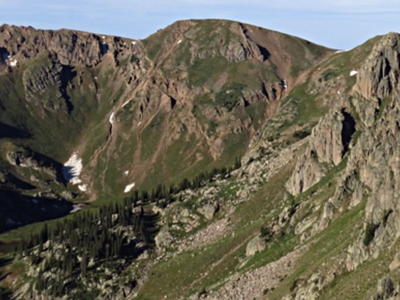
Endlich Mesa Trail
Endlich Mesa trail #534 is just over 21 miles long and an access point to the Weminuche Wilderness, heading north to Columbine Pass.
The official TH is reached by a number of poorly maintained forest roads. The most reliable trail access is near the Vallecito Lake Event Centre just off CO-501. -107.5554097756167, 37.426356167786906. This trail used to be part of a loop but a portion of the area was on private property and is being developed into lots. Part of this trail runs through a burn area. About 5 miles up there is a large meadow and at the top, above treeline, a large mesa. Much of the trail can be hot direct sun in summer.
This trail ties into an extensive trail network and the Weminuche Wilderness.
Location of TH - 37°28'37.4"N 107°37'52.5"W - Google Maps
Alternate titles -
Freeman Meadow re Endlich Mesa Trail - 5 miles - 875' gain
- Suitable Activities: Hiking, Snowshoeing
- Snowshoeing Category: Basic
- Seasons: Year-round
- Weather: View weather forecast
- Avalanche Terrain Rating Simple View avalanche forecast.
- 12,700 ft
-
Land Manager:
U.S. Forest Service
Weminuche Wilderness Area, Columbine Ranger District (SJNF)
- Parking Permit Required: USFS Permits & Passes
- Recommended Party Size: 12
- Maximum Party Size: 15
- Maximum Route/Place Capacity: 15
- AllTrails
This is a list of titles that represent the variations of trips you can take at this route/place. This includes side trips, extensions and peak combinations. Not seeing a title that fits your trip? Log in and send us updates, images, or resources.
- Freeman Meadow re Endlich Mesa Trail
There are no resources for this route/place. Log in and send us updates, images, or resources.
