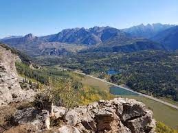
Elbert Creek Trail
This moderately challenging trail near the Durango and Purgatory Ski Area can be hiked to the top as an out and back, or used to reach a spur trail to local favorite Castle Rock. At the top turn-round point, the trail offers access to a number of other local trails.
This trail is USFS #912. The TH is located right off US-550 and provides a good starting point for exploration of the regional trail network used by bikers and hikers. At the top one can continue onto the Big Lick Trail USFS #499.
Location of TH - Elbert Creek trailhead - Google Maps
Alternate titles -
Elbert Creek Trail Out and Back
Castle Rock via Elbert Creek Trail
- Suitable Activities: Biking, Hiking, Snowshoeing
- Snowshoeing Category: Intermediate
- Seasons: June, July, August, September, October
- Weather: View weather forecast
- Avalanche Terrain Rating Challenging View avalanche forecast.
- Difficulty: Moderate
- Length: 9.8 mi
- Elevation Gain: 1,735 ft
- 10,448 ft
-
Land Manager:
U.S. Forest Service
South San Juan Wilderness Area, Columbine Ranger District (SJNF)
- Parking Permit Required: USFS Permits & Passes
- Recommended Party Size: 12
- Maximum Party Size: 12
- Maximum Route/Place Capacity: 12
- AllTrails
- Hiking Project
This is a list of titles that represent the variations of trips you can take at this route/place. This includes side trips, extensions and peak combinations. Not seeing a title that fits your trip? Log in and send us updates, images, or resources.
- Elbert Creek Trail Out and Back
- Castle Rock via Elbert Creek Trail
There are no resources for this route/place. Log in and send us updates, images, or resources.
