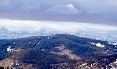
Deer Peak
Deer Peak (11,572'). The third highest peak in the Wet Mountains offers views across the Wet Valley to the Sangre de Cristo range. The trail passes through old growth forest mixed with high meadows, making this a pleasant hike.
The hike starts by hiking up Deer Peak Rd starting at the intersection of FR360, Deer Peak Rd, and Gardner Road. TH 38.017184413114194, -105.16611614954448.
Another recommended route is mostly off trail, up the Treasure Gulch Ravine, which starts at a gate at the top of a tight hairpin turn. 38.028368938928686, -105.15428621467338. 3.6 miles, 1214' gain
The two routes can be combined into a loop. See Summit Post https://www.summitpost.org/deer-peak/779863
This area is known as great for mushroom hunters.
The summit is covered in radio towers.
Location - Deer Peak - Google Maps
- Suitable Activities: Backcountry Nordic Skiing, Backcountry Skiing/Splitboarding, Biking, Hiking, Snowshoeing
- Snowshoeing Category: Basic
- Seasons: April, May, June, July, August, September, October, November
- Weather: View weather forecast
- Avalanche Terrain Rating Challenging View avalanche forecast.
- Length: 6.5 mi
- Elevation Gain: 925 ft
- 11,572 ft
-
Land Manager:
U.S. Forest Service
San Carlos Ranger District (PSINF)
- Parking Permit Required: USFS Permits & Passes
- Recommended Party Size: 12
- Maximum Party Size: 15
- Maximum Route/Place Capacity: 15
- CoTrex
- summitpost
There are no resources for this route/place. Log in and send us updates, images, or resources.
