Deer Mountain - The Long Way - RMNP
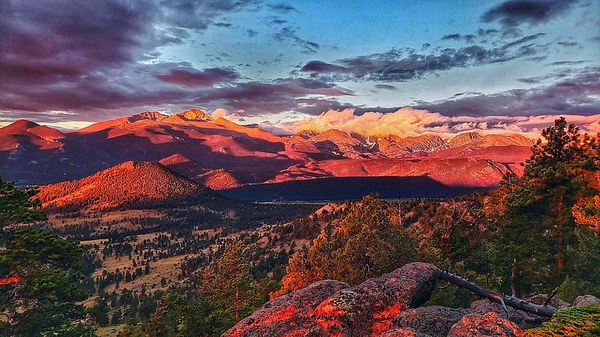
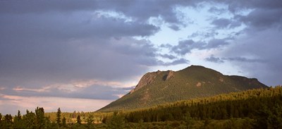
A journey to the summit of Deer Mountain in Rocky Mountain National Park from the North Deer Mountain Trailhead is a scenic adventure through pine forests and expansive meadows. This 12-mile loop hike offers breathtaking views of snow-capped peaks, with a steady 2,500-foot elevation gain that rewards your efforts with sweeping vistas of the surrounding valleys and alpine landscapes. As you ascend, the trail winds through rocky switchbacks, and the summit reveals panoramic scenes of Longs Peak, the Continental Divide, and the grandeur of the park's rugged wilderness.
This 12-mile loop hike to the summit of Deer Mountain in Rocky Mountain National Park, beginning at the North Deer Mountain Trailhead and returning via the South Deer Mountain Trail, is an awe-inspiring adventure. The journey starts with a gentle climb through aromatic ponderosa pines and golden meadows, where elk and mule deer often graze in the early morning light. As you ascend, the trail becomes more rugged, with switchbacks that offer glimpses of Longs Peak and the Continental Divide. The steady 2,500-foot elevation gain rewards your effort with sweeping views of the park’s vast wilderness, and as you approach the summit, the expansive vistas open up to reveal towering peaks, deep valleys, and alpine lakes glistening in the distance.
The descent via the South Deer Mountain Trail offers a completely different perspective, making this loop a unique experience. The trail meanders down through dense forests, occasionally breaking into rocky clearings where the grandeur of the surrounding mountains unfolds from new angles. The south-facing slopes offer stunning views of Moraine Park and the winding Big Thompson River far below. This route's solitude, combined with the ever-changing landscapes, makes it feel like a truly immersive wilderness escape, leaving hikers with a sense of both accomplishment and wonder at the natural beauty of the Rockies.

- Suitable Activities: Hiking
- Snowshoeing Category: Intermediate
- Seasons: Year-round
- Weather: View weather forecast
- Difficulty: Moderate
- Length: 12.0 mi
- Elevation Gain: 2,500 ft
- 10,013 ft
- Land Manager: National Park Service
- Parking Permit Required: National Park Entrance Fees
- Recommended Party Size: 12
- Maximum Party Size: 12
- Maximum Route/Place Capacity: 12
- Trails Illustrated 200
- CalTopo
There are no resources for this route/place. Log in and send us updates, images, or resources.
