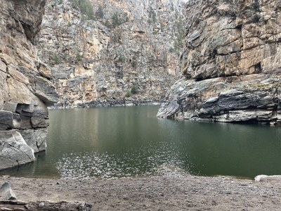
Curecanti NRA
The Curecanti National Recreation Area is located between Montrose and Gunnison. It's comprised of three reservoirs, interesting geology and some scenic hiking trails.
See this National Park Service page for more info on the Curecanti NRA. The park is open year-round, but icy conditions may exist in the winter. Click here for more info on hiking in the NRA
Alternate titles -
Curecanti Creek Trail – 4 miles, 836 ft elevation gain.
Dillon Pinnacles Trail – 3.8 miles, 492 ft elevation gain.
Hermits Rest Trail – 5.2 miles, 1800 ft elevation gain.
- Suitable Activities: Hiking
- Seasons: Year-round
- Weather: View weather forecast
- Difficulty: Moderate to Difficult
- Length: 5.0 mi
- Land Manager: National Park Service
- Parking Permit Required: National Park Entrance Fees
- Recommended Party Size: 12
- Maximum Party Size: 12
- Maximum Route/Place Capacity: 12
This is a list of titles that represent the variations of trips you can take at this route/place. This includes side trips, extensions and peak combinations. Not seeing a title that fits your trip? Log in and send us updates, images, or resources.
- Curecanti NRA - Curecanti Creek Trail
- Curecanti NRA - Dillon Pinnacles Trail
- Curecanti NRA - Hermits Rest Trail
There are no resources for this route/place. Log in and send us updates, images, or resources.
