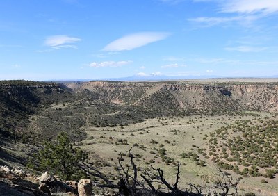
Cucharas Canyon
Canyon and mesa country in southeastern Colorado. Hike on/off trail.
- Wilson Crossing - 3.4 mile - 620 ft Elevation gain
- North Fork Trail - 1-mile trail that begins at the trailhead on Trinchera Peak Rd
- Trinchera Peak Road - 4 mile trail that's good for hiking and backpacking
Alternate titles -
- Cucharas Canyon Loop — 13.3 miles, 1610 ft gain
- Cucharas Canyon One Way — 8.6 miles, 635 ft gain
More information available at BLM Royal Gorge Field Office
- Suitable Activities: Hiking
- Seasons: Year-round, March, April, September, October, November
- Weather: View weather forecast
- Land Manager: Bureau of Land Management
- Parking Permit Required: BLM Permits & Passes
- Recommended Party Size: 8
- Maximum Party Size: 12
- Maximum Route/Place Capacity: 12
This is a list of titles that represent the variations of trips you can take at this route/place. This includes side trips, extensions and peak combinations. Not seeing a title that fits your trip? Log in and send us updates, images, or resources.
- Cucharas Canyon Loop
- Cucharas Canyon One Way
There are no resources for this route/place. Log in and send us updates, images, or resources.
