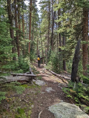
Cub Creek Trail
This trail starts in Evergreen and continues for 18 miles one-way into the Mt Blue Sky (Evans) Wilderness. On the west, the trail ends at Resthouse Meadows. Pass though woodlands and meadows, plus a large burn area. Numerous junctions provide access to all the Wilderness area and the Upper Bear Creek Basin.
This trail (USFS #40) starts at the Cub Creek TH in Evergreen and ends at the Beaver Meadows Trail junction. It makes for a great out and back of any length, or take one of the many intersecting trails to Staunton State Park, Summit Flats, Beartracks Lakes, Lincoln Lake, Beaver Meadows, Rosalie Trail, or the Deer Creek or Tanglewood TH's near Bailey.
Shadow mountain is located on the eastern side of Mt Evans Wilderness Area. Its coordinates are 39° 33' 37'' N, 105° 27' 20'' W. It can be accessed most easily via the Cub Creek trail from Evergreen.
Cub Creek to Staunton State Park and back: North Elk Creek Trail is closed March 1 -June 15 "to minimize trail damage during spring conditions."
- Suitable Activities: Hiking, Nordic Skiing, Snowshoeing
- Seasons: Year-round
- Weather: View weather forecast
- Length: 18.0 mi
- Elevation Gain: 3,035 ft
- 11,404 ft
-
Land Manager:
U.S. Forest Service
Mount Blue Sky Wilderness Area (formerly Mount Evans), South Platte Ranger District (PSINF)
- Parking Permit Required: USFS Permits & Passes
- Recommended Party Size: 12
- Maximum Party Size: 15
- Maximum Route/Place Capacity: 15
- COTREX
This is a list of titles that represent the variations of trips you can take at this route/place. This includes side trips, extensions and peak combinations. Not seeing a title that fits your trip? Log in and send us updates, images, or resources.
- Cub Creek Trail to Shadow Mountain
- Cub Creek to Staunton State Park and back
There are no resources for this route/place. Log in and send us updates, images, or resources.
