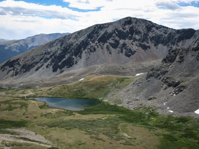
Crystal Lakes
Amazing scenery with a view of Ten Mile Range; trailhead near Breckenridge.
A 4WD road leads to Lower Crystal Lake and then a hiking trail continues for approximately 2 miles to Upper Crystal Lake.
USFS description & map: https://www.fs.usda.gov/Internet/FSE_DOCUMENTS/stelprdb5187053.pdf
- Suitable Activities: Backpacking, Camping, Exploring Nature, Fly Fishing, Hiking, Nordic Skiing, Snowshoeing
- Seasons: Year-round
- Weather: View weather forecast
- Difficulty: Moderate
- Elevation Gain: 1,200 ft
- 12,980 ft
-
Land Manager:
U.S. Forest Service
Dillon Ranger District (WRNF)
- Parking Permit Required: USFS Permits & Passes
- Recommended Party Size: 12
- Maximum Party Size: 12
- Maximum Route/Place Capacity: 12
This is a list of titles that represent the variations of trips you can take at this route/place. This includes side trips, extensions and peak combinations. Not seeing a title that fits your trip? Log in and send us updates, images, or resources.
- BPX: Crystal Lakes via Spruce Creek Trailhead
There are no resources for this route/place. Log in and send us updates, images, or resources.
