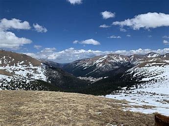
Jones Pass Road - ATA Clinic
Jones Pass Road is accessible to most vehicles. Jones Pass is along the Continental Divide. The road is 7 miles out and back. Activities year round.
For further information see: Arapaho & Roosevelt National Forests Pawnee National Grassland - Jones Pass Trailhead (usda.gov)
Jones Pass Road: This is specific to staying on the road with a larger party than is allowed on the Forest Service trails surrounding the road. Park at the Mine lot and walk up the road.
- Suitable Activities: Avalanche Education
- Seasons: Year-round
- Weather: View weather forecast
- View avalanche forecast.
- Length: 7.0 mi
-
Land Manager:
U.S. Forest Service
Clear Creek Ranger District (ARNF)
- Parking Permit Required: USFS Permits & Passes
- Recommended Party Size: 30
- Maximum Party Size: 38
- Maximum Route/Place Capacity: 38
This is a list of titles that represent the variations of trips you can take at this route/place. This includes side trips, extensions and peak combinations. Not seeing a title that fits your trip? Log in and send us updates, images, or resources.
- Jones Pass Road
There are no resources for this route/place. Log in and send us updates, images, or resources.
