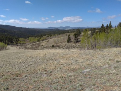
Colorado Trail
567 miles of trail between Denver and Durango
Colorado Trail: Segment 1
The Indian Creek Trailhead (ICT) serves as an alternate starting point of Segment 1 of The Colorado Trail and is dog friendly. The ICT is in the mountains about 10 miles south of Waterton Canyon and is found along Colorado Hwy 67 between Sedalia and Deckers.
To reach The Colorado Trail from the ICT, walk past the outhouse to the west and downhill through the Equestrian campground area. The singletrack ICT #800 'West Leg' begins where the equestrian camping road makes a loop.
Segment 1 of the Colorado Trail (#1776) begins at Waterton Canyon. The canyon offers a 6.5-mile route to a view of Strontia Springs dam. The trail continues to the south of the reservoir for about 10 miles to the confluence of the North Fork of the South Platte River and the Gudy Gaskil bridge.
Waterton Canyon also connects to the Roxborough State Park trail system and the Indian Creek Trail (#800).
Colorado Trail: Collegiate West Route: 84.8 miles on the western slopes of the Collegiate Peaks. Total elevation gain is 19,800', Collegiate Peaks Wilderness
This CT segment passes through gorgeous valleys, forests, lakes, and mountain passes. There is also abundant wildlife along the Collegiate West Route. Expect to see little furries like pikas, the ubiquitous marmot, maybe moose and bear, too. Highlights include Hope Pass, Lake Ann and Lake Ann Pass, Tunnel Gulch and Alpine Tunnel Historical Railroad Site, several 14'ers and 13'ers. The CT Collegiate West Route is comprised of five segments.
CW01 - Twin Lakes to Sheep Gulch - 9.9mi
CW02 - Sheep Gulch to Cottonwood Pass TH - 25.9mi
CW03 - Cottonwood Pass TH to Tincup Pass Rd - 16.1mi
CW04 - Tincup Pass Rd to Boss Lake TH - 16.9mi
CW05 - Boss Lake TH to Collegiate West/East Junction - 16.0mi
Colorado Trail: Long Gulch to Rock Creek: 8 miles, 830 feet of elevation gain, Lost Creek Wilderness
This hike is along the Colorado Trail and is a part of the larger segment 5 hike of about 16 miles that ultimately ends at Kenosha Pass. Long Gulch to Rock Creek takes a path through aspen trees and bristlecone pines.
Travel west from Denver on 285 for about 60 miles to Kenosha Pass. Continue about 3.2 miles to Lost Park Road, turn left. Follow this road for 11 miles. Look for a road marked FS RD 817 on the left near a gully. Drive or walk up this road for 0.1 mile to its end at the very small Long Gulch Trailhead. Walk a short distance up the gully to the Forest Service register. Angle slightly to the right and follow the access trail to its intersection with the Colorado Trail.
- Suitable Activities: Hiking, Backpacking, Climbing, Mountaineering, Snowshoeing
- Climbing Category: Basic Alpine Climb
- Snowshoeing Category: Intermediate
- Seasons: Year-round
- Weather: View weather forecast
- Land Manager: U.S. Forest Service
- Parking Permit Required: USFS Permits & Passes
- Recommended Party Size: 12
- Maximum Party Size: 12
- Maximum Route/Place Capacity: 12
- National Geographic from REI
This is a list of titles that represent the variations of trips you can take at this route/place. This includes side trips, extensions and peak combinations. Not seeing a title that fits your trip? Log in and send us updates, images, or resources.
- Colorado Trail: Segment 1
- Colorado Trail: Segment 5
- Colorado Trail: Collegiate West Route
- Colorado Trail: Long Gulch to Rock Creek
There are no resources for this route/place. Log in and send us updates, images, or resources.
