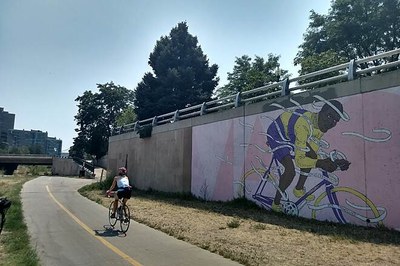
Cherry Creek Trail
This 45-mile trail is an important regional trail in the Denver Metro Area and beyond. It begins at the North Platte Confluence in Lower Downtown Denver and terminates past CO-86 near Franktown in Douglas County. Popular with bikers, skaters, and neighborhood walkers.
The trail has numerous entry and exit points all along its length. Most of the trail is eight feet wide and paved, with a few gravel sections near the southern end. It links into other regional trails such as the Highline Canal and the Platte River Trail, and passes through Denver, Arapahoe and Douglas Counties, which share in its management.
In Denver County, the trail parallels Cherry Creek through urban landscapes and parks and into the suburbs. Highlights of the Denver portion of the route include the Cherry Creek Shopping District, beautiful neighborhoods, and Four Mile House Historic Park.
In Arapahoe County, the trail runs through Cherry Creek State Park, which offers hiking trails, campgrounds, numerous water activities, and a beach at Cherry Creek Reservoir.
Continuing south over the Douglas County line, the trail passes through suburban and then increasingly rural areas, before ending at a wooded and hilly dead-end in Franktown, not far from Castlewood Canyon State Park.
- Suitable Activities: Biking, Exploring Nature, Family, Hiking
- Seasons: Year-round
- Weather: View weather forecast
- Length: 45.0 mi
- Elevation Gain: 1,220 ft
- 6,394 ft
- Land Manager: Land Manager Varies
- Parking Permit Required: Other
- Recommended Party Size: 12
- Maximum Party Size: 12
- Maximum Route/Place Capacity: 12
This is a list of titles that represent the variations of trips you can take at this route/place. This includes side trips, extensions and peak combinations. Not seeing a title that fits your trip? Log in and send us updates, images, or resources.
- Attach all the many trips out there with Cherry Creek Trail in the title.
There are no resources for this route/place. Log in and send us updates, images, or resources.
